Area Overview for CB23 6ES
Photos of CB23 6ES
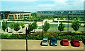
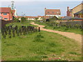
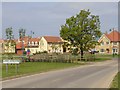
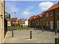
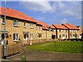
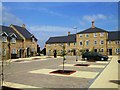
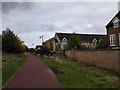
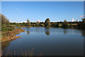
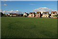
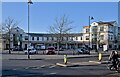
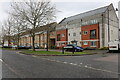
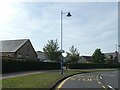
76 photos from this area
Area Information
Key information about the CB23 6ES including its size, population, and administrative classification.
- Area Type
- Postcode
- Area Size
- 1.8 hectares
- Population
- 1320
- Population Density
- 618 people/km²
House Prices in CB23 6ES
32
Properties
£298,017
Average Sold Price
£140,000
Lowest Price
£615,000
Highest Price
Showing 32 properties
| Address | Type | Beds | Baths | Last Sale Price | Last Sale Date | |
|---|---|---|---|---|---|---|
| 34 Swansley Lane, Cambourne, CB23 6ES | Detached | 5 | 3 | £615,000 | Jan 2024 | |
| 56 Swansley Lane, Cambourne, CB23 6ES | Detached | 4 | 2 | £450,000 | Aug 2023 | |
| 44 Swansley Lane, Cambourne, CB23 6ES | house | 3 | 1 | £330,000 | Apr 2022 | |
| 26 Swansley Lane, Cambourne, CB23 6ES | Terraced | 3 | - | £365,000 | Dec 2021 | |
| 54 Swansley Lane, Cambourne, CB23 6ES | Maisonette | - | - | £185,000 | Sep 2021 | |
| 32 Swansley Lane, Cambourne, CB23 6ES | Terraced | 3 | 1 | £285,000 | May 2020 | |
| 38 Swansley Lane, Cambourne, CB23 6ES | Detached | 5 | 3 | £567,500 | Feb 2020 | |
| 40 Swansley Lane, Cambourne, CB23 6ES | Detached | 4 | - | £415,000 | Nov 2018 | |
| 52 Swansley Lane, Cambourne, CB23 6ES | Semi-detached | 4 | 2 | £307,000 | Sep 2018 | |
| 42 Swansley Lane, Cambourne, CB23 6ES | Detached | 1 | - | £172,000 | Oct 2015 |
Page 1 of 4
Energy Efficiency in CB23 6ES
Amenities
Schools
| Rank | School | Type | Entry gender | Ages |
|---|
Explore more schools in this area
Go to Schools tabDemographics
Household Size
Family (3-5 people)
most common
Accommodation Type
Houses
most common
Tenure
61
majority
Ethnic Group
White
most common
Religion
N/A
most common
Household Composition
N/A
most common
Age
47
median
Adults (30-64 years)
most common
Household Deprivation
N/A
with no deprivation
NS-SEC
50
in Lower managerial occupations
Explore more demographic insights in this area
Go to Demographics tabPlanning
Planning Constraints
- Flood RiskPremium
- Ramsar Wetland SitesPremium
- Area of Outstanding Natural BeautyPremium
- Protected Nature ReservePremium
- Protected WoodlandPremium