Area Overview for CB23 6BZ
Photos of CB23 6BZ
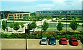
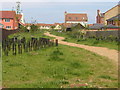
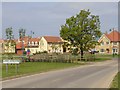
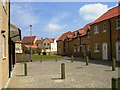
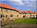
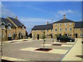
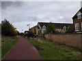
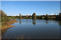
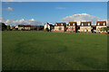
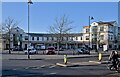
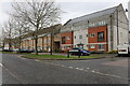
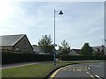
76 photos from this area
Area Information
Key information about the CB23 6BZ including its size, population, and administrative classification.
- Area Type
- Postcode
- Area Size
- 7139 m²
- Population
- 1320
- Population Density
- 618 people/km²
House Prices in CB23 6BZ
17
Properties
£351,315
Average Sold Price
£94,950
Lowest Price
£630,000
Highest Price
Showing 17 properties
| Address | Type | Beds | Baths | Last Sale Price | Last Sale Date | |
|---|---|---|---|---|---|---|
| 13 Shearling Drive, Cambourne, CB23 6BZ | house | 5 | 1 | £550,000 | Jun 2022 | |
| 10 Shearling Drive, Cambourne, CB23 6BZ | Detached | 6 | - | £630,000 | Aug 2020 | |
| 12 Shearling Drive, Cambourne, CB23 6BZ | Detached | 4 | - | £495,000 | Jul 2019 | |
| 9 Shearling Drive, Cambourne, CB23 6BZ | Detached | 5 | - | £500,000 | Jan 2019 | |
| 18 Shearling Drive, Cambourne, CB23 6BZ | Detached | 6 | - | £537,500 | Aug 2016 | |
| 2 Shearling Drive, Cambourne, CB23 6BZ | Detached | 4 | - | £310,690 | Jul 2016 | |
| 3 Shearling Drive, Cambourne, CB23 6BZ | house | 4 | 3 | £295,000 | Jan 2015 | |
| 7 Shearling Drive, Cambourne, CB23 6BZ | house | 5 | - | £329,995 | Jun 2011 | |
| 8 Shearling Drive, Cambourne, CB23 6BZ | house | - | - | £330,000 | Oct 2008 | |
| 6 Shearling Drive, Cambourne, CB23 6BZ | Detached | - | - | £340,000 | Dec 2002 |
Page 1 of 2
Energy Efficiency in CB23 6BZ
Amenities
Schools
| Rank | School | Type | Entry gender | Ages |
|---|
Explore more schools in this area
Go to Schools tabDemographics
Household Size
Family (3-5 people)
most common
Accommodation Type
Houses
most common
Tenure
61
majority
Ethnic Group
White
most common
Religion
N/A
most common
Household Composition
N/A
most common
Age
47
median
Adults (30-64 years)
most common
Household Deprivation
N/A
with no deprivation
NS-SEC
50
in Lower managerial occupations
Explore more demographic insights in this area
Go to Demographics tabPlanning
Planning Constraints
- Flood RiskPremium
- Ramsar Wetland SitesPremium
- Area of Outstanding Natural BeautyPremium
- Protected Nature ReservePremium
- Protected WoodlandPremium