Area Overview for CB23 2YY
Photos of CB23 2YY
Area Information
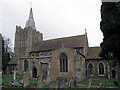
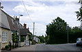
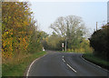
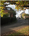
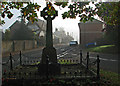
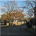
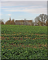
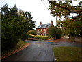
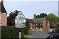
Living in CB23 2YY means being part of a small, tightly knit residential cluster in South Cambridgeshire, just 10 miles west of Cambridge. The area, centred around the village of Bourn, sits in a wooded valley along the Bourn Brook, surrounded by nearby villages like Caxton, Eltisley, and Cambourne. With a population of 2,831 and a density of 201 people per square kilometre, it retains a village feel despite its proximity to urban centres. The area has a long history, first recorded in the Domesday Book as *Brune*, and features landmarks such as Bourn Windmill, one of the UK’s oldest surviving windmills, and the 12th-century Church of St Mary and St Helena. Daily life here balances rural tranquillity with access to nearby towns, offering a quiet alternative to Cambridge’s pace while retaining connections to its cultural and economic hubs. The mix of historic architecture and modern amenities makes CB23 2YY a compelling choice for those seeking a settled, community-focused lifestyle.
- Area Type
- Postcode
- Area Size
- Not available
- Population
- 2831
- Population Density
- 201 people/km²
The property market in CB23 2YY is characterised by high home ownership (78%) and a predominance of houses. This suggests a market skewed towards owner-occupied homes rather than rental properties, which may indicate a demand for larger, family-friendly residences. The focus on houses, rather than flats or apartments, implies a preference for private, spacious living, typical of rural or semi-rural areas. Given the small size of the postcode area, the housing stock is likely limited, making properties here relatively scarce. Buyers should consider that the market may cater more to those seeking long-term stability rather than investment opportunities. The proximity to Cambridge and other nearby villages could also influence property values, offering a balance between rural charm and access to urban amenities. For those prioritising space and a quiet lifestyle, CB23 2YY presents a niche opportunity within a constrained market.
House Prices in CB23 2YY
No properties found in this postcode.
Energy Efficiency in CB23 2YY
Residents of CB23 2YY have access to a range of retail amenities within practical reach, including five notable venues such as Co-op Cambridge, Morrisons Great, and Co-op Cambourne. These shops provide everyday essentials, reducing the need for long trips to larger centres. While no dining or leisure facilities are explicitly listed, the presence of multiple retail outlets suggests a convenience-focused lifestyle, ideal for those prioritising ease of access to services. The area’s small size means amenities are likely clustered closely, fostering a sense of community. The combination of local shops and proximity to nearby towns like Cambridge offers a balance between rural simplicity and urban connectivity. This accessibility enhances daily life, ensuring residents can meet their needs without sacrificing the area’s tranquil character.
Amenities
Schools
Residents of CB23 2YY have access to two primary schools: Bourn CofE Primary School and Bourn CofE Primary Academy. Both institutions serve the local community, with the latter holding a ‘good’ Ofsted rating, indicating a solid standard of education. The presence of two primary schools within the area provides families with options for their children’s early education, reducing the need for long commutes. The mix of schools suggests a focus on community-based education, likely with smaller class sizes and a strong emphasis on local ties. While no secondary schools are listed, the proximity to larger towns like Cambridge would provide additional educational choices. For families prioritising quality schooling, the availability of a rated primary school is a significant advantage, supporting the area’s appeal as a family-friendly location.
| Rank | School | Type | Entry gender | Ages |
|---|
Explore more schools in this area
Go to Schools tabDemographics
The population of CB23 2YY is predominantly adults aged 30–64, with a median age of 47. This suggests a mature, stable community, likely composed of families and professionals settled in the area. Home ownership is high, with 78% of residents owning their homes, indicating a long-term presence rather than a transient population. The accommodation type is primarily houses, reflecting a preference for larger, private properties over flats. The predominant ethnic group is White, though no specific diversity statistics are provided. The age profile and home ownership rates suggest a neighbourhood with strong family ties and low turnover. With no data on deprivation, it is reasonable to infer that the area benefits from relatively high standards of living, supported by its proximity to services and low crime rates. This demographic profile aligns with a community focused on stability, privacy, and a connection to local heritage.
Household Size
Accommodation Type
Tenure
Ethnic Group
Religion
Household Composition
Age
Household Deprivation
NS-SEC
Explore more demographic insights in this area
Go to Demographics tabPlanning
Planning Constraints
- Flood RiskPremium
- Ramsar Wetland SitesPremium
- Area of Outstanding Natural BeautyPremium
- Protected Nature ReservePremium
- Protected WoodlandPremium