Area Overview for CB23 2UB
Photos of CB23 2UB
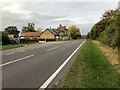
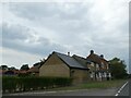
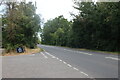
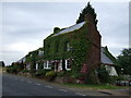
26 photos from this area
Area Information
Key information about the CB23 2UB including its size, population, and administrative classification.
- Area Type
- Postcode
- Area Size
- 22.0 hectares
- Population
- 1789
- Population Density
- 38 people/km²
House Prices in CB23 2UB
16
Properties
£277,318
Average Sold Price
£135,000
Lowest Price
£595,000
Highest Price
Showing 16 properties
| Address | Type | Beds | Baths | Last Sale Price | Last Sale Date | |
|---|---|---|---|---|---|---|
| 58 Old North Road, Longstowe, CB23 2UB | Terraced | 2 | 1 | £270,000 | Nov 2024 | |
| 20 Old North Road, Longstowe, CB23 2UB | Bungalow | 2 | 2 | £435,000 | Jun 2019 | |
| 92 Old North Road, Longstowe, CB23 2UB | Detached | 4 | - | £595,000 | Sep 2014 | |
| 86 Old North Road, Longstowe, CB23 2UB | Terraced | - | - | £268,000 | Jul 2008 | |
| 80 Old North Road, Longstowe, CB23 2UB | house | - | - | £219,000 | Jul 2007 | |
| 84 Old North Road, Longstowe, CB23 2UB | Terraced | 2 | 2 | £195,000 | Apr 2007 | |
| 30 Old North Road, Longstowe, CB23 2UB | Detached | 7 | 4 | £255,000 | Jan 2007 | |
| 62 Old North Road, Longstowe, CB23 2UB | Terraced | - | - | £198,500 | Nov 2006 | |
| 70 Old North Road, Longstowe, CB23 2UB | Detached | - | - | £230,000 | Nov 2000 | |
| 104 Old North Road, Longstowe, CB23 2UB | house | - | - | £250,000 | Nov 1999 |
Page 1 of 2
Energy Efficiency in CB23 2UB
Amenities
Schools
| Rank | School | Type | Entry gender | Ages |
|---|
Explore more schools in this area
Go to Schools tabDemographics
Household Size
Two person
most common
Accommodation Type
Houses
most common
Tenure
74
majority
Ethnic Group
White
most common
Religion
N/A
most common
Household Composition
N/A
most common
Age
47
median
Adults (30-64 years)
most common
Household Deprivation
N/A
with no deprivation
NS-SEC
42
in Lower managerial occupations
Explore more demographic insights in this area
Go to Demographics tabPlanning
Planning Constraints
- Flood RiskPremium
- Ramsar Wetland SitesPremium
- Area of Outstanding Natural BeautyPremium
- Protected Nature ReservePremium
- Protected WoodlandPremium