Area Overview for CB22 4PS
Photos of CB22 4PS
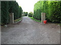


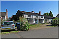
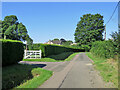
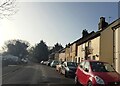
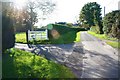
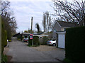

26 photos from this area
Area Information
Key information about the CB22 4PS including its size, population, and administrative classification.
- Area Type
- Postcode
- Area Size
- 25.6 hectares
- Population
- 1505
- Population Density
- 602 people/km²
House Prices in CB22 4PS
29
Properties
£444,857
Average Sold Price
£148,000
Lowest Price
£885,000
Highest Price
Showing 29 properties
| Address | Type | Beds | Baths | Last Sale Price | Last Sale Date | |
|---|---|---|---|---|---|---|
| 6A Moorfield Road, Duxford, CB22 4PS | Detached | 4 | 3 | £825,000 | Oct 2025 | |
| 30 Moorfield Road, Duxford, CB22 4PS | Detached | 4 | 2 | £885,000 | Jul 2025 | |
| 8A Moorfield Road, Duxford, CB22 4PS | Flat | 2 | 2 | £312,000 | May 2024 | |
| 8 Moorfield Road, Duxford, CB22 4PS | Flat | 2 | - | £281,500 | Sep 2021 | |
| 4 Moorfield Road, Duxford, CB22 4PS | Detached | 3 | 2 | £440,000 | Nov 2020 | |
| 38 Moorfield Road, Duxford, CB22 4PS | Detached | 3 | 1 | £615,000 | May 2017 | |
| 8B Moorfield Road, Duxford, CB22 4PS | Flat | - | - | £185,000 | Dec 2015 | |
| 34 Moorfield Road, Duxford, CB22 4PS | house | - | - | £560,000 | Nov 2015 | |
| 36 Moorfield Road, Duxford, CB22 4PS | Detached | 4 | - | £465,000 | Jul 2015 | |
| 32 Moorfield Road, Duxford, CB22 4PS | house | 4 | - | £505,000 | Jul 2011 |
Page 1 of 3
Energy Efficiency in CB22 4PS
Amenities
Schools
| Rank | School | Type | Entry gender | Ages |
|---|
Explore more schools in this area
Go to Schools tabDemographics
Household Size
Two person
most common
Accommodation Type
Houses
most common
Tenure
73
majority
Ethnic Group
White
most common
Religion
N/A
most common
Household Composition
N/A
most common
Age
47
median
Adults (30-64 years)
most common
Household Deprivation
N/A
with no deprivation
NS-SEC
55
in Lower managerial occupations
Explore more demographic insights in this area
Go to Demographics tabPlanning
Planning Constraints
- Flood RiskPremium
- Ramsar Wetland SitesPremium
- Area of Outstanding Natural BeautyPremium
- Protected Nature ReservePremium
- Protected WoodlandPremium