Area Overview for CB22 4FB
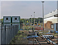
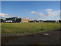
Photos of CB22 4FB
Area Information
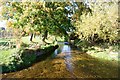
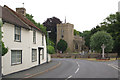
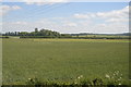
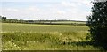
Living in CB22 4FB, a small residential cluster in Cambridgeshire, means being part of a community rooted in both rural heritage and modern commuter convenience. The area’s 1,460 residents are spread across 1,124 households, with a population density of 68 people per square kilometre, reflecting a compact, close-knit environment. Historically a village with agricultural roots, Duxford has evolved into a commuter hub, with many residents working beyond the parish. The Imperial War Museum Duxford, housed on the former RAF airfield, stands as a defining landmark, drawing visitors and adding cultural depth to the area. Daily life here balances quiet rural charm with accessible amenities, from local shops and pubs to transport links that connect to Cambridge and beyond. The presence of two active churches, a community centre, and a primary school underscores a mix of tradition and contemporary living. For those seeking a peaceful yet connected lifestyle, CB22 4FB offers a unique blend of history, infrastructure, and proximity to larger urban centres.
- Area Type
- Postcode
- Area Size
- Not available
- Population
- 1460
- Population Density
- 68 people/km²
The property market in CB22 4FB is characterised by a high rate of home ownership (67%) and a predominance of houses over flats, reflecting a suburban or rural housing stock. This suggests the area is more suited to families or individuals seeking larger, private residences rather than rental properties. The limited number of households (1,124) relative to the population (1,460) indicates a mix of single-person and multi-generational homes, though specific data on household types is not provided. As a small area, the housing market may have limited inventory, but the high ownership rate implies stability and long-term residency. Buyers should consider the area’s proximity to transport links and amenities, which may enhance property value. However, the small size of the postcode means the immediate surroundings—such as nearby villages or towns—will play a significant role in property availability and desirability.
House Prices in CB22 4FB
Showing 1 properties
| Address | Type | Beds | Baths | Last Sale Price | Last Sale Date | |
|---|---|---|---|---|---|---|
| Cambridge Biopolymers Ltd, Ickleton Road, Duxford, CB22 4FB | Office | - | - | - | - |
Energy Efficiency in CB22 4FB
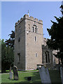
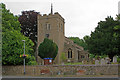
Daily life in CB22 4FB is enriched by a mix of historical and modern amenities. The Imperial War Museum Duxford, housed on a former RAF airfield, is a major attraction, offering exhibitions and events that draw both locals and visitors. Within the village, St. Peter’s Church and the 13th-century Duxford Chapel provide cultural and spiritual anchors, while the Community Centre (opened in 2020) offers a café and meeting spaces. Local pubs like the Plough and the John Barleycorn, alongside a deli and primary school, create a tight-knit social fabric. Retail options include M&S, Spar, and Co-op, ensuring everyday needs are met. The area’s character is defined by its balance of heritage and practicality, with amenities that cater to both leisure and daily convenience. Residents enjoy a quiet rural setting without sacrificing access to essential services or transport links.
Amenities
Schools
| Rank | School | Type | Entry gender | Ages |
|---|
Explore more schools in this area
Go to Schools tabDemographics
The population of CB22 4FB has a median age of 47, with the majority of residents aged between 30 and 64. This suggests a community skewed towards adults in their prime working years, many of whom may be commuting to nearby towns or cities. Home ownership is high at 67%, indicating a stable, long-term resident base. The area is predominantly composed of houses rather than flats, aligning with the characteristics of a suburban or rural setting. The predominant ethnic group is White, reflecting the broader demographic patterns of the region. With no specific data on deprivation or diversity beyond this, the area appears to be a homogenous community with a focus on family-oriented living. The age profile and ownership rates suggest a mature, established population with limited turnover, which can influence local services and amenities.
Household Size
Accommodation Type
Tenure
Ethnic Group
Religion
Household Composition
Age
Household Deprivation
NS-SEC
Explore more demographic insights in this area
Go to Demographics tabPlanning
Planning Constraints
- Flood RiskPremium
- Ramsar Wetland SitesPremium
- Area of Outstanding Natural BeautyPremium
- Protected Nature ReservePremium
- Protected WoodlandPremium