Area Overview for CB22 3HJ
Photos of CB22 3HJ


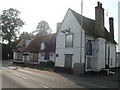


88 photos from this area
Area Information
Key information about the CB22 3HJ including its size, population, and administrative classification.
- Area Type
- Postcode
- Area Size
- 8.8 hectares
- Population
- 1631
- Population Density
- 1361 people/km²
House Prices in CB22 3HJ
72
Properties
£302,561
Average Sold Price
£73,950
Lowest Price
£960,000
Highest Price
Showing 72 properties
| Address | Type | Beds | Baths | Last Sale Price | Last Sale Date | |
|---|---|---|---|---|---|---|
| 111 High Street, Sawston, CB22 3HJ | Detached | 2 | 2 | £135,000 | Oct 2023 | |
| 109 High Street, Sawston, CB22 3HJ | Terraced | 3 | 1 | £280,000 | Oct 2022 | |
| 108 High Street, Sawston, CB22 3HJ | house | 1 | - | £500,000 | Jun 2022 | |
| 124 High Street, Sawston, CB22 3HJ | Terraced | 2 | 1 | £290,000 | May 2022 | |
| 115 High Street, Sawston, CB22 3HJ | Semi-detached | 3 | 2 | £490,000 | Jan 2022 | |
| 92 High Street, Sawston, CB22 3HJ | Detached | 4 | 2 | £530,000 | Sep 2019 | |
| 128 High Street, Sawston, CB22 3HJ | Terraced | 3 | 1 | £295,000 | Jun 2019 | |
| 146 High Street, Sawston, CB22 3HJ | Detached | 5 | 5 | £960,000 | Jan 2019 | |
| 153 High Street, Sawston, CB22 3HJ | Detached | 4 | - | £508,268 | Jun 2018 | |
| 119 High Street, Sawston, CB22 3HJ | Detached | 2 | 1 | £315,000 | Feb 2018 |
Page 1 of 8
Energy Efficiency in CB22 3HJ
Amenities
Schools
| Rank | School | Type | Entry gender | Ages |
|---|
Explore more schools in this area
Go to Schools tabDemographics
Household Size
Two person
most common
Accommodation Type
Houses
most common
Tenure
64
majority
Ethnic Group
White
most common
Religion
N/A
most common
Household Composition
N/A
most common
Age
47
median
Adults (30-64 years)
most common
Household Deprivation
N/A
with no deprivation
NS-SEC
41
in Lower managerial occupations
Explore more demographic insights in this area
Go to Demographics tabPlanning
Planning Constraints
- Flood RiskPremium
- Ramsar Wetland SitesPremium
- Area of Outstanding Natural BeautyPremium
- Protected Nature ReservePremium
- Protected WoodlandPremium