Area Overview for CB22 3DQ
Photos of CB22 3DQ


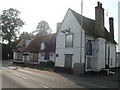


88 photos from this area
Area Information
Key information about the CB22 3DQ including its size, population, and administrative classification.
- Area Type
- Postcode
- Area Size
- 4.0 hectares
- Population
- 1482
- Population Density
- 380 people/km²
House Prices in CB22 3DQ
60
Properties
£370,116
Average Sold Price
£62,500
Lowest Price
£910,000
Highest Price
Showing 60 properties
| Address | Type | Beds | Baths | Last Sale Price | Last Sale Date | |
|---|---|---|---|---|---|---|
| 11 Babraham Road, Sawston, CB22 3DQ | Bungalow | 5 | 3 | £850,000 | Jun 2025 | |
| 43 Babraham Road, Sawston, CB22 3DQ | house | - | - | £441,000 | Aug 2024 | |
| 47 Babraham Road, Sawston, CB22 3DQ | Semi-detached | 3 | 1 | £405,000 | Mar 2024 | |
| 18 Babraham Road, Sawston, CB22 3DQ | house | - | - | £435,000 | Jun 2023 | |
| 23 Babraham Road, Sawston, CB22 3DQ | Detached | 4 | 2 | £910,000 | Feb 2023 | |
| 31 Babraham Road, Sawston, CB22 3DQ | Semi-detached | 3 | 2 | £420,000 | Sep 2022 | |
| 41 Babraham Road, Sawston, CB22 3DQ | house | - | - | £494,500 | Apr 2022 | |
| 1B Babraham Road, Sawston, CB22 3DQ | house | - | - | £660,000 | Apr 2022 | |
| 37 Babraham Road, Sawston, CB22 3DQ | Semi-detached | 3 | 1 | £460,000 | Dec 2021 | |
| 49 Babraham Road, Sawston, CB22 3DQ | house | 4 | - | £395,000 | Jun 2021 |
Page 1 of 6
Energy Efficiency in CB22 3DQ
Amenities
Schools
| Rank | School | Type | Entry gender | Ages |
|---|
Explore more schools in this area
Go to Schools tabDemographics
Household Size
Two person
most common
Accommodation Type
Houses
most common
Tenure
71
majority
Ethnic Group
White
most common
Religion
N/A
most common
Household Composition
N/A
most common
Age
47
median
Adults (30-64 years)
most common
Household Deprivation
N/A
with no deprivation
NS-SEC
40
in Lower managerial occupations
Explore more demographic insights in this area
Go to Demographics tabPlanning
Planning Constraints
- Flood RiskPremium
- Ramsar Wetland SitesPremium
- Area of Outstanding Natural BeautyPremium
- Protected Nature ReservePremium
- Protected WoodlandPremium