Area Overview for CB21 4QF
Photos of CB21 4QF
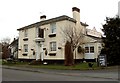

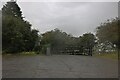
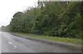

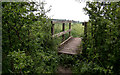
10 photos from this area
Area Information
Key information about the CB21 4QF including its size, population, and administrative classification.
- Area Type
- Postcode
- Area Size
- 49.2 hectares
- Population
- 1404
- Population Density
- 47 people/km²
House Prices in CB21 4QF
20
Properties
£318,417
Average Sold Price
£157,500
Lowest Price
£460,000
Highest Price
Showing 20 properties
| Address | Type | Beds | Baths | Last Sale Price | Last Sale Date | |
|---|---|---|---|---|---|---|
| Little Gables, Linton Road, Horseheath, CB21 4QF | Detached | 2 | - | £400,000 | Nov 2018 | |
| The Gables, Linton Road, Horseheath, CB21 4QF | Detached | 2 | 1 | £460,000 | Nov 2018 | |
| Magnolia House, Linton Road, Horseheath, CB21 4QF | Detached | 3 | 2 | £350,000 | May 2014 | |
| Halcyon, Linton Road, Horseheath, CB21 4QF | house | 4 | - | £355,000 | Jun 2012 | |
| Bedale, Linton Road, Horseheath, CB21 4QF | Detached | - | - | £188,000 | Sep 2002 | |
| The Old Police House, Linton Road, Horseheath, CB21 4QF | Detached | - | - | £157,500 | Sep 1999 | |
| Manor Farm Cottage, Linton Road, Horseheath, CB21 4QF | Cottage | 2 | 1 | - | - | |
| 4, Manor Farm Cottage, Linton Road, Horseheath, CB21 4QF | Cottage | 2 | 1 | - | - | |
| Managers Accommodation, The Old Red Lion, Linton Road, Horseheath, CB21 4QF | Flat | - | - | - | - | |
| Guest Rooms 1 To 8, The Old Red Lion, Linton Road, Horseheath, CB21 4QF | hotel | - | - | - | - |
Page 1 of 2
Energy Efficiency in CB21 4QF
Amenities
Schools
| Rank | School | Type | Entry gender | Ages |
|---|
Explore more schools in this area
Go to Schools tabDemographics
Household Size
Two person
most common
Accommodation Type
Houses
most common
Tenure
75
majority
Ethnic Group
White
most common
Religion
N/A
most common
Household Composition
N/A
most common
Age
47
median
Adults (30-64 years)
most common
Household Deprivation
N/A
with no deprivation
NS-SEC
42
in Lower managerial occupations
Explore more demographic insights in this area
Go to Demographics tabPlanning
Planning Constraints
- Flood RiskPremium
- Ramsar Wetland SitesPremium
- Area of Outstanding Natural BeautyPremium
- Protected Nature ReservePremium
- Protected WoodlandPremium