Area Overview for CB2 9GG
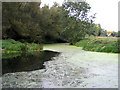
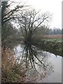
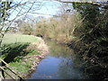
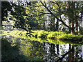
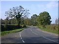
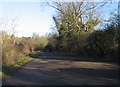
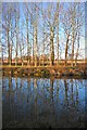
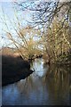
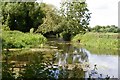
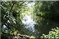
Photos of CB2 9GG


Area Information
Living in CB2 9GG means residing within a defined postcode covering a small residential cluster of 3.9 hectares. This compact location accommodates 2,560 people, resulting in a low population density of 214 people per square kilometre. The area stands apart from denser urban sprawl due to its spacious footprint, which allows residents to enjoy more open space relative to the number of neighbours. Daily life here is characterised by a quiet environment where the scarcity of dwellings per hectare reduces noise and congestion. Prospective buyers should note that the settlement functions as a contained neighbourhood rather than a sprawling district. The specific boundaries of this postcode create a defined community where most residents likely know one another through shared local infrastructure. You will find a setting that balances the privacy of a rural holiday home with the practical access needed for daily travel. This concentration of households in a limited area ensures that public services and amenities remain easily reachable without requiring long commutes within the locality itself. The distinct character of this small geographic unit offers a tangible sense of place that larger administrative zones often lack.
- Area Type
- Postcode
- Area Size
- 3.9 hectares
- Population
- 2560
- Population Density
- 214 people/km²
The housing market in CB2 9GG is overwhelmingly dominated by owner-occupation rather than the private rental sector. With 70% of homes owned by the residents, the local market thrives on long-term ownership and investment retention. The accommodation type is almost exclusively houses, fitting the preferences of the demographic primarily found in this postcode. This means you will rarely encounter blocks of flats or purpose-built rental apartments within this 3.9-hectare area. Buyers looking for detached or semi-detached properties will find the stock aligns perfectly with the needs of the local population. The prevalence of houses suggests that land value is significant, and extensions or garden modifications are likely common themes among homes here. The high ownership percentage also means that any vacant properties are part of a larger chain of transactions rather than isolated rental listings. When assessing homes near CB2 9GG, expect to see family-sized dwellings suitable for the 30-to-64-year-old age group that dominates the community. The lack of rented stock indicates that people move here to buy and stay, creating a market where price stability is often higher in times of fluctuation elsewhere.
House Prices in CB2 9GG
Showing 20 properties
| Address | Type | Beds | Baths | Last Sale Price | Last Sale Date | |
|---|---|---|---|---|---|---|
| 17 Britannia Walk, Trumpington, South Trumpington, CB2 9GG | Flat | - | - | £405,000 | Aug 2024 | |
| 20 Britannia Walk, Trumpington, South Trumpington, CB2 9GG | Flat | - | - | £384,995 | May 2021 | |
| 16 Britannia Walk, Trumpington, South Trumpington, CB2 9GG | Flat | - | - | £387,995 | Dec 2020 | |
| 5 Britannia Walk, Trumpington, South Trumpington, CB2 9GG | Flat | - | - | - | - | |
| 12 Britannia Walk, Trumpington, South Trumpington, CB2 9GG | house | - | - | - | - | |
| 11 Britannia Walk, Trumpington, South Trumpington, CB2 9GG | house | - | - | - | - | |
| 3 Britannia Walk, Trumpington, South Trumpington, CB2 9GG | Flat | - | - | - | - | |
| 13 Britannia Walk, Trumpington, South Trumpington, CB2 9GG | Flat | - | - | - | - | |
| 8 Britannia Walk, Trumpington, South Trumpington, CB2 9GG | house | - | - | - | - | |
| 19 Britannia Walk, Trumpington, South Trumpington, CB2 9GG | Flat | - | - | - | - |
Energy Efficiency in CB2 9GG
Residential life in CB2 9GG is supported by a network of practical amenities within easy reach. Residents have access to five notable retail venues, including Sainsburys Cambridge, Waitrose Cambridge, and another Sainsburys Cambridge location. These supermarkets provide essential groceries and household goods without the need to travel into the main city centre. For travel and commute, five rail stations are available nearby, specifically Shelford Railway Station, Foxton Railway Station, and Shepreth Railway Station. These stations offer regular train services that connect the small postcode to larger hubs across the region. Two airports are also listed in the nearby amenities section, identified as Cambridge Airport and Cambridge Airport, providing air travel options for visiting family or business trips. The concentration of these transport nodes means that despite the residential nature of the area, you remain well-connected to the outside world. The availability of Waitrose alongside mainstream retailers like Sainsburys suggests a shopping environment that caters to varying tastes and dietary requirements. You can manage most daily errands from your doorstep while retaining the flexibility to explore the city or countryside when you choose.
Amenities
Schools
Families living in CB2 9GG have access to two primary schools listed within the immediate educational landscape. Haslingfield Endowed Primary School offers primary education and holds a good Ofsted rating, reflecting solid teaching standards and management. Trumpington Meadows Primary School also operates as a primary institution and shares the good Ofsted rating, providing an alternative for families seeking different pedagogical approaches. Both schools are rated good, ensuring that educational quality remains consistently high for children in the area. The mix of school types is purely primary level within this specific dataset, meaning older children will likely move to secondary facilities further afield once they complete their compulsory education. The presence of these two rated institutions provides families with a choice of local schooling for early childhood and primary years. You do not have secondary school names or performance data for the immediate vicinity of this postcode in the current information. However, the existence of a good rated primary school suggests the area is family-friendly and planning authorities support local education needs. The proximity of these schools indicates that the residential zones of CB2 9GG were developed with families and their children in mind.
| Rank | School | Type | Entry gender | Ages |
|---|
Explore more schools in this area
Go to Schools tabDemographics
The community within CB2 9GG is populated by a mature demographic where the median age sits at 47 years old. Adults aged between 30 and 64 years form the most common age range, indicating a neighbourhood populated by established households rather than young tenants. This age profile suggests a stable population with deeply rooted families or retirees seeking a settled life. Home ownership is high, with 70% of residents owning their property outright or with a mortgage. This high rate of ownership signals a long-term commitment to the area and stability in local housing tenures. Homes in this postcode are predominantly houses, reflecting the preference of this age group for separate fencing and traditional living spaces over flats or maisonettes. The predominant ethnic group is White, which mirrors the broader demographic trends seen across similar suburban and semi-rural parts of Cambridgeshire. Deprivation data specific to this small postcode is not included in the provided dataset, but the high ownership rate and mature age profile generally correlate with low deprivation indices in established English suburbs. You are looking at a community defined by stability, with fewer young professionals or transient workers creating a quieter social atmosphere compared to university towns.
Household Size
Accommodation Type
Tenure
Ethnic Group
Religion
Household Composition
Age
Household Deprivation
NS-SEC
Explore more demographic insights in this area
Go to Demographics tabPlanning
Planning Constraints
- Flood RiskPremium
- Ramsar Wetland SitesPremium
- Area of Outstanding Natural BeautyPremium
- Protected Nature ReservePremium
- Protected WoodlandPremium