Area Overview for CB2 5SZ
Photos of CB2 5SZ
Area Information
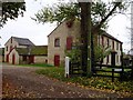
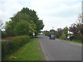
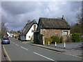
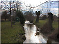
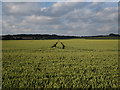
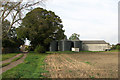
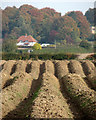
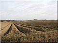
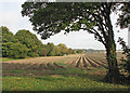
CB2 5SZ occupies a specific residential cluster within the civil parish of Stapleford in Cambridgeshire. This pocket lies approximately four miles south of Cambridge on the right-hand bank of the River Granta. The location sits between Great Shelford and Sawston, anchoring a community defined by its ancient origins near a ford marked by a post. The parish covers 1835 acres and includes historical landmarks such as the Wandlebury Ring Iron Age hill fort. With a population of 1676 residents, the density averages 243 people per square kilometre. Living in this small postcode means adopting a lifestyle rooted in history while remaining close to urban opportunities. The area retains its identity as a village where prehistoric habitation evidence coexists with later architectural developments. History notes that the surname Stapleford derives from a ford, a fact visible in the local tapestry of English heritage. Residents benefit from being situated on land that includes a Grade II listed building and a public house with roots dating back to the 17th century. Daily life here involves engaging with a tight-knit community rather than a sprawling suburb. You purchase a home in a setting that values continuity and historical significance.
- Area Type
- Postcode
- Area Size
- Not available
- Population
- 1676
- Population Density
- 243 people/km²
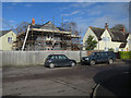
Housing in CB2 5SZ is characterised by a strong market for owner-occupied homes. The accommodation type is exclusively houses, meaning townhouses and rental apartments are not part of the local stock available for purchase. With 83% of the population owning their homes, this postcode represents a stable environment for buying rather than renting. You are entering a market where financial commitment is common, which often supports better-maintained properties over time. The small population of 1676 ensures that properties sell within a focused community circle rather than a broad metropolitan pool. The density of 243 people per square kilometre indicates manageable sprawl without urban congestion. When viewing homes in CB2 5SZ, expect to see structures that align with village planning constraints and historical character. The area does not cater to luxury rental seekers or student movers. Your search for a house here aligns with the preference of the majority of current residents to stay put. Property values may reflect the premium placed on ownership in such a tight-knit setting.
House Prices in CB2 5SZ
No properties found in this postcode.
Energy Efficiency in CB2 5SZ
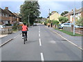
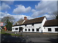
Residents of CB2 5SZ enjoy a network of amenities within practical reach for daily errands and leisure. The retail directory lists five distinct shops, including Spar, Tesco Great, and Co-op Great, ensuring food and household needs are met without travel. Transport options are numerous, with five rail stations and two airport terminals nearby for those with wider mobility needs. The area's history highlights The Rose Public House on London Road, a venue with parts dating to 1665 and 1707. This establishment, licensed by 1728, offers a sense of continuity alongside modern shopping options. You will find five notable retail points clustered here for convenience. The presence of these specific supermarkets and a historic pub creates a balanced lifestyle environment. Daily life involves stopping at the local Co-op or Tesco Great rather than driving to urban centres. The blend of ancient heritage sites like the Wandlebury Ring and modern retail stores defines the character of the postcode. You access these facilities while remaining in a quiet village setting.
Amenities
Schools
Families seeking education options near CB2 5SZ have access to specific local institutions. Stapleford Community Primary School serves as the main educational facility for young children in the catchment area. This school operates under the primary category, providing foundational learning for residents' offspring. For children with special educational needs, Green Hedges School is available as a special school option. This facility ensures that specific learning requirements are met within a designated location. The mix of primary and special education offers a complete local spectrum for young learners without needing to travel far. You do not have information on Ofsted ratings for these specific schools in the current data set. Consequently, decisions rely on the reputation of the names and the proximity to the CB2 5SZ cluster. These schools represent the closest formal education providers to the residential cluster. Choosing a home here places your children within walking distance of these named establishments.
| Rank | School | Type | Entry gender | Ages |
|---|
Explore more schools in this area
Go to Schools tabDemographics
The community within CB2 5SZ reflects a settled population where stability is the norm. The median age for residents is 47 years, placing the demographic heart firmly within the adult bracket of 30 to 64 years old. This age profile suggests a neighbourhood populated by established households rather than transient young professionals or families with very small children. Home ownership is the dominant form of tenure, with 83% of residents owning their property outright or with a mortgage. This high rate indicates a long-term commitment to the area rather than a short-term rental arrangement. The population is predominantly ethnically White, contributing to a homogeneous social fabric. Accommodation types are primarily houses, fitting the profile of a village where terraced or apartment living is rare. Deprivation levels are not highlighted in the available data, so the focus remains on the affluent nature of ownership. You will find that neighbours here are likely local families who have cemented their roots for decades. The social structure is built on mutual familiarity and shared history within these 1676 households.
Household Size
Accommodation Type
Tenure
Ethnic Group
Religion
Household Composition
Age
Household Deprivation
NS-SEC
Explore more demographic insights in this area
Go to Demographics tabPlanning
Planning Constraints
- Flood RiskPremium
- Ramsar Wetland SitesPremium
- Area of Outstanding Natural BeautyPremium
- Protected Nature ReservePremium
- Protected WoodlandPremium