Area Overview for CB2 4QY
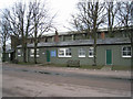
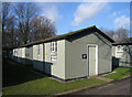
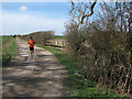
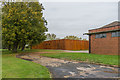
Photos of CB2 4QY
Area Information
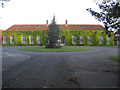
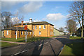
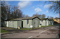
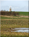
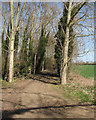
Living in CB2 4QY means residing within the civil parish of Thriplow and Heathfield in South Cambridgeshire. This small residential cluster has a population of 1501 people spread across an area with a density of 103 people per square kilometre. The postcode sits within a Conservation Area designated as NH/14, which preserves the historic lanes linking four medieval manors. You will find the village of Thriplow and the nearby hamlet of Heathfield defined by these ancient connections to the Icknield Way. The area is dominated by houses arranged around historic properties including Thriplow Bury, The Manor House, and Gowards. St George's Church stands as a landmark with its tower and spire dating from the 1300s. This Conservation Area designation creates a distinct heritage feel throughout the neighbourhood. You can see the church tower from many vantage points in the village. The hamlet of Heathfield developed from the early 1920s as housing for RAF Duxford staff, with continuing expansion through subsequent decades. Most recent houses were built in the 2000s. The Green Man pub operates as a community-owned venue since 2012, while the village shop has been community-run since 2007. Betty Boothroyd, former Speaker of the House of Commons, lived here in her later years and is buried at St George's. You will experience a predominantly rural setting with timber-framed houses, thatched cottages, and farmsteads. The area sits within 12 listed buildings including three Grade II* properties. Thriplow Meadows and Thriplow Peat Holes are designated as SSSIs nearby. This postcode offers a rural living experience with strong community facilities and historic preservation in place.
- Area Type
- Postcode
- Area Size
- Not available
- Population
- 1501
- Population Density
- 103 people/km²
The property market in CB2 4QY reflects the characteristics of an established rural village. Houses form the predominant accommodation type throughout this postcode, meaning you will search primarily for detached or semi-detached single-family homes. Seventy-six percent of residents own their properties, creating an owner-occupied market rather than a rental-heavy environment. This high ownership rate suggests properties change hands through purchase and sale rather than frequent tenancy turnover. The small residential cluster of 1501 people means limited inventory compared to larger urban postcodes, so availability will depend on individual property listings. Historic listings dominate the local housing stock, with 12 listed buildings including three Grade II* properties in Thriplow nearby. Thriplow Bury, The Manor House, and Gowards add to the heritage character of the area. You will find timber-framed houses, thatched cottages, and farmsteads mixed with more modern developments from the 2000s in Heathfield. The Conservation Area designation influences what renovations you can undertake on properties within this neighbourhood. Estate agents list properties through traditional channels, and you should expect decent interest but limited competition. Values reflect the rural setting and historic character, not the premiums of city-centre living. Homeownership stability means properties appreciate steadily without the volatility seen in high-turnover rental markets. When you consider buying, focus on condition assessment and heritage requirements. The hamlet of Heathfield offers newer housing opposite Duxford Imperial War Museum, potentially presenting different valuations to established Thriplow properties. Search listings across the civil parish boundaries to find suitable homes within practical reach.
House Prices in CB2 4QY
No properties found in this postcode.
Energy Efficiency in CB2 4QY
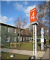
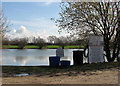
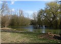
Residents of CB2 4QY access amenities within practical reach that support daily life in this rural village setting. Five rail options connect you to broader networks, including Whittlesford Parkway Railway Station, Foxton Railway Station, and Great Chesterford Railway Station. For everyday shopping needs, five retail establishments offer convenience, with M&S Whittlesford Cambridge BP, Spar, and Co-op Sawston among the notable options. The Green Man pub operates as a community-owned venue since 2012, providing a traditional gathering place for villagers. The village shop has been community-run since 2007, maintaining local ownership and community spirit. A recreation ground, village hall, cricket ground, and old smithy museum serve recreational needs throughout the parish. Thriplow Meadows SSSI and Thriplow Peat Hols offer natural spaces for walking and outdoor activities. You can walk to The Green where the War Memorial stands alongside historic buildings. The cricket ground accommodates local sporting organisations, while the village hall hosts community events, meetings, and social activities. Access to Cambridge remains practical though you will need to travel outside the immediate postcode for major shopping or premium services. This blend of rural tranquility and community facilities creates a lifestyle where facilities feel accessible without urban density. The conservation area character means new development is limited, preserving the historic feel you will experience when moving to this area.
Amenities
Schools
Two primary schools serve families living in and near CB2 4QY. Thriplow CofE VA Primary School appears on the list of nearby educational institutions. You will also find Thriplow CofE Primary School within practical reach of this postcode. Both schools operate as Church of England establishments, which you should consider if religious education matters to your family. These institutions educate children within the parish that includes Thriplow and Heathfield. The presence of two primary schools indicates the parish supports young families alongside longer-term residents. You will need to check specific Ofsted ratings for each school through official government channels, as the data does not include these assessment results. Both schools sit within the civil parish boundaries, meaning students from CB2 4QY typically attend them for their primary education. The mix of Church of England schools reflects the historic religious character of the area, with St George's Church dating from the late 1200s. These schools serve the predominantly adult population aged 30 to 64 years, suggesting younger families are a minority but present demographic. You should verify catchment boundaries and admission criteria when evaluating school options. Neither school appears as a secondary institution, confirming this is a primary education catchment area. Families with older children will need to consider schooling arrangements beyond these two primary establishments. The existence of two schools provides some flexibility in choosing between them based on location, values, and available capacity. Check travel distances from your potential property to each school before making decisions.
| Rank | School | Type | Entry gender | Ages |
|---|
Explore more schools in this area
Go to Schools tabDemographics
The community in CB2 4QY has a median age of 47 years across its 1501 residents. Adults between 30 and 64 years represent the most common age range within this population. This demographic profile suggests a mature community with established households rather than young professionals or families in transition. Seventy-six percent of residents own their homes, indicating this is primarily an owner-occupied area rather than a rental market. You will find mostly houses as the predominant accommodation type throughout the postcode. The predominant ethnic group is White, which reflects the area's historic settlement patterns in rural Cambridgeshire. Population density stands at 103 people per square kilometre, placing this postcode above the national average for rural areas. This moderate density allows for a quiet residential lifestyle while maintaining reasonable access to local facilities. The age structure suggests stability with fewer children in households, though two primary schools serve families nearby. Home ownership levels of 76 percent indicate financial security among residents and a community invested in long-term local living. You move to this area knowing neighbours have established roots and owned their properties for extended periods. The relatively older population means you will encounter residents with deep local knowledge and historical connections to Thriplow and Heathfield. This demographic composition creates a stable environment where community institutions and facilities serve long-standing residents rather than transient populations.
Household Size
Accommodation Type
Tenure
Ethnic Group
Religion
Household Composition
Age
Household Deprivation
NS-SEC
Explore more demographic insights in this area
Go to Demographics tabPlanning
Planning Constraints
- Flood RiskPremium
- Ramsar Wetland SitesPremium
- Area of Outstanding Natural BeautyPremium
- Protected Nature ReservePremium
- Protected WoodlandPremium