Area Overview for CB2 4AT
Photos of CB2 4AT
Area Information
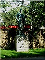
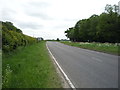
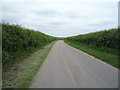
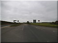
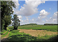
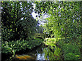
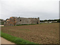
Living in CB2 4AT means inhabiting a small, rural cluster of homes in the South Cambridgeshire district, approximately 6 miles south-east of Cambridge. With a population of 1,279 and a low density of 47 people per square kilometre, this area retains a quiet, village-like character. The postcode is part of Babraham, a civil parish defined by its rural landscape, bounded by the River Granta and historic roads like the Icknield Way. Daily life here is shaped by proximity to the Babraham Institute, a hub for cell and molecular biology research, and the remnants of medieval wool trade routes. The area’s charm lies in its blend of historical roots and modern scientific relevance, with landmarks like Babraham Hall and the Church of St Peter adding to its distinct identity. Residents benefit from nearby transport links, including three railway stations, and a modest network of local shops. While small, CB2 4AT offers a self-contained lifestyle with access to Cambridge’s amenities within commuting distance.
- Area Type
- Postcode
- Area Size
- Not available
- Population
- 1279
- Population Density
- 47 people/km²
CB2 4AT is an owner-occupied area, with 64% of residents living in homes they own. The accommodation type is predominantly houses, which suggests a focus on family homes and larger properties rather than apartments or rental units. This aligns with the area’s rural character and low population density. Given the small size of the postcode, the housing stock is likely limited, meaning buyers may need to consider nearby areas for more options. The presence of houses rather than flats indicates a market suited to those prioritising space and privacy. For buyers, this suggests a stable, long-term investment opportunity, though competition for properties may be higher due to the area’s appeal. The proximity to Cambridge also means the local property market could be influenced by commuters seeking a quieter, suburban alternative to the city.
House Prices in CB2 4AT
No properties found in this postcode.
Energy Efficiency in CB2 4AT
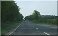
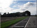
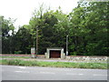
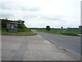
Daily life in CB2 4AT is shaped by its small-scale amenities, including five retail outlets such as Spar Harvest and Co-op Sawston, offering essentials within walking distance. The village’s rural character is complemented by nearby transport links, with three railway stations providing access to Cambridge and other towns. Residents can also reach Cambridge Airport easily, adding to the area’s connectivity. The presence of historical sites like Babraham Hall and the Church of St Peter adds cultural depth, while the proximity to the Babraham Institute introduces a research-focused atmosphere. The mix of local shops, transport options, and historical landmarks creates a lifestyle that balances convenience with a sense of community.
Amenities
Schools
The nearest school to CB2 4AT is Babraham CofE (VC) Primary School, which serves the local community with primary education. While no secondary schools are listed in the data, the presence of a primary school indicates the area is suitable for families with younger children. The school’s location within the village ensures ease of access for residents, though parents may need to travel further for secondary education. The absence of additional schools in the data means the educational landscape is limited to primary provision, which could be a consideration for families planning for long-term schooling.
| Rank | School | Type | Entry gender | Ages |
|---|
Explore more schools in this area
Go to Schools tabDemographics
The community in CB2 4AT is predominantly middle-aged, with a median age of 47 and the most common age range being adults aged 30–64. Home ownership is strong, with 64% of residents owning their homes, suggesting a stable, long-term population. The accommodation type is primarily houses, reflecting a residential area with larger properties rather than flats or apartments. The predominant ethnic group is White, aligning with broader regional demographics. This age profile indicates a community likely focused on family life and professional careers, with fewer young families or retirees compared to other areas. The absence of specific deprivation data means quality of life is inferred from the area’s low population density, historical infrastructure, and access to amenities like schools and transport.
Household Size
Accommodation Type
Tenure
Ethnic Group
Religion
Household Composition
Age
Household Deprivation
NS-SEC
Explore more demographic insights in this area
Go to Demographics tabPlanning
Planning Constraints
- Flood RiskPremium
- Ramsar Wetland SitesPremium
- Area of Outstanding Natural BeautyPremium
- Protected Nature ReservePremium
- Protected WoodlandPremium