Area Overview for CB2 4AR
Photos of CB2 4AR

Area Information
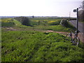
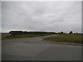
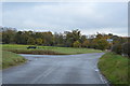
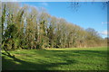
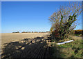
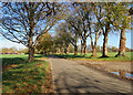
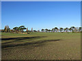
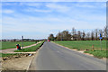
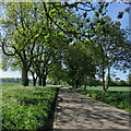
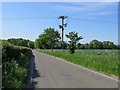
Living in CB2 4AR means settling in a rural parish of just 1,279 people, where the population density of 47 people per square kilometre reflects a quiet, low-rise residential cluster. Nestled six miles south-east of Cambridge, this area is defined by its historical roots and proximity to the Babraham Institute, a hub for cell and molecular biology research. The village is bordered by the River Granta and ancient routes like the Icknield Way, offering a blend of rural tranquillity and academic influence. Daily life here is shaped by its small-scale character, with a population skewed towards adults aged 30–64. The area’s modest size means a tight-knit community, where the presence of the Babraham Hall and historical inns like The Angel suggest a heritage steeped in local tradition. For those seeking a peaceful, low-density environment with access to research-driven opportunities, CB2 4AR provides a unique balance of rural charm and proximity to Cambridge’s resources.
- Area Type
- Postcode
- Area Size
- Not available
- Population
- 1279
- Population Density
- 47 people/km²
The property market in CB2 4AR is characterised by a high rate of home ownership (64%) and a predominance of houses, suggesting a focus on family-friendly, owner-occupied homes. Given the area’s small size and low population density, the housing stock is likely limited, with properties concentrated in a rural setting. This makes the market competitive for buyers seeking a quiet, low-density environment near Cambridge. The presence of the Babraham Institute may also contribute to demand, attracting professionals working in research or academia. However, the limited number of properties means buyers must consider proximity to the area’s immediate surroundings for more options. The mix of historical architecture, including Jacobean-style Babraham Hall, adds to the area’s distinct appeal, though it may also mean fewer modern developments.
House Prices in CB2 4AR
No properties found in this postcode.
Energy Efficiency in CB2 4AR
Residents of CB2 4AR have access to a range of amenities within practical reach, including five retail outlets such as Co-op Sawston, Spar, and M&S Whittlesford Cambridge BP. These shops cater to daily needs, from groceries to fuel, supporting a self-sufficient lifestyle. The area’s rail stations connect to nearby towns, while the presence of two airports, both named Cambridge Airport, suggests potential for regional travel. The rural character of the parish, combined with its proximity to the Babraham Institute, offers a mix of historical sites and modern research facilities. The lack of large leisure or dining venues means residents may need to travel to Cambridge for more extensive options. However, the small-scale amenities contribute to a quiet, community-focused lifestyle, ideal for those prioritising convenience and tranquillity over urban vibrancy.
Amenities
Schools
The nearest school to CB2 4AR is Babraham CofE (VC) Primary School, which serves the local community with primary education. While the data lists this school twice, it is the only named institution provided, indicating a focus on primary-level schooling in the area. The absence of secondary schools or additional educational facilities suggests that families may need to look beyond CB2 4AR for comprehensive schooling options. The single primary school reflects the small size of the parish and its reliance on nearby centres for higher education. For families prioritising proximity to schools, the availability of a primary institution is a key consideration, though the lack of secondary options may require planning for longer commutes or alternative schooling arrangements.
| Rank | School | Type | Entry gender | Ages |
|---|
Explore more schools in this area
Go to Schools tabDemographics
The community in CB2 4AR is predominantly middle-aged, with a median age of 47 and the majority of residents falling within the 30–64 age range. This suggests a population largely composed of established professionals and families, reflecting the area’s historical ties to research and agriculture. Home ownership is high, at 64%, with houses being the primary accommodation type, indicating a stable, long-term resident base. The predominant ethnic group is White, which aligns with the area’s traditional demographic profile. The absence of specific data on deprivation or diversity metrics means the community’s socioeconomic dynamics remain largely unexplored in the provided information. However, the age profile and home ownership rate imply a mature, settled population with limited turnover, which can influence local services and amenities.
Household Size
Accommodation Type
Tenure
Ethnic Group
Religion
Household Composition
Age
Household Deprivation
NS-SEC
Explore more demographic insights in this area
Go to Demographics tabPlanning
Planning Constraints
- Flood RiskPremium
- Ramsar Wetland SitesPremium
- Area of Outstanding Natural BeautyPremium
- Protected Nature ReservePremium
- Protected WoodlandPremium