Area Overview for CB2 1TJ
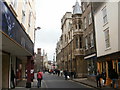
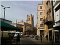
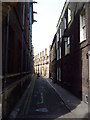
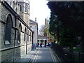
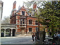
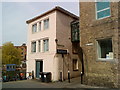
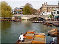
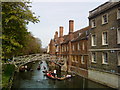
Photos of CB2 1TJ
Area Information
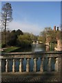
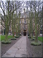
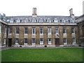
CB2 1TJ is a compact residential postcode in Cambridge, England, spanning 4.7 hectares and home to 5,735 residents. Its density—1,510 people per square kilometre—reflects a tightly knit community, yet the area retains a distinct identity rooted in history. Situated on the west bank of the River Cam, it straddles the boundary between Cambridge and the parish of Grantchester. The area’s character is shaped by its past as a patchwork of former parishes, with pockets of historic development like No. 3 Summerfield, built in 1868. Today, it balances modern living with heritage, offering proximity to institutions like Newnham College and recreational spaces such as Lammas Land. Young adults dominate the population, with a median age of 22, suggesting a dynamic, student-influenced environment. This is a place where academic and residential life intertwine, with easy access to Cambridge’s cultural and educational hubs.
- Area Type
- Postcode
- Area Size
- 4.7 hectares
- Population
- 5735
- Population Density
- 1510 people/km²
CB2 1TJ is primarily an owner-occupied area, with 57% of homes owned by residents rather than rented. The accommodation type is predominantly houses, which is typical for Cambridge’s suburban wards. Given the postcode’s small size—just 4.7 hectares—the housing stock is limited, making it a niche market for buyers seeking properties in a historically rich, low-density setting. The proximity to Cambridge’s academic institutions may attract professionals and academics, though the area’s small footprint means buyers must consider nearby suburbs for more options. The mix of owner-occupied homes and the presence of independent schools suggest a community prioritising stability and family-oriented living, though the high population density indicates a need for efficient use of space.
House Prices in CB2 1TJ
Showing 19 properties
| Address | Type | Beds | Baths | Last Sale Price | Last Sale Date | |
|---|---|---|---|---|---|---|
| Stairs O And P Gatehouse Building, Trinity Hall, Trinity Lane, Cambridge, CB2 1TJ | studentAccommodation | - | - | - | - | |
| May Ball Site, Trinity Hall, Trinity Lane, Cambridge, CB2 1TJ | commercial | - | - | - | - | |
| Stairs P And Q Thornton Building, Trinity Hall, Trinity Lane, Cambridge, CB2 1TJ | studentAccommodation | - | - | - | - | |
| Stairs A U T And S North Court, Trinity Hall, Trinity Lane, Cambridge, CB2 1TJ | studentAccommodation | - | - | - | - | |
| Stairs L M And N Latham Building, Trinity Hall, Trinity Lane, Cambridge, CB2 1TJ | studentAccommodation | - | - | - | - | |
| Stairs B And C Front Court, Trinity Hall, Trinity Lane, Cambridge, CB2 1TJ | studentAccommodation | - | - | - | - | |
| Stairs F G And H Avery Court, Trinity Hall, Trinity Lane, Cambridge, CB2 1TJ | studentAccommodation | - | - | - | - | |
| Masters Lodge, Trinity Hall, Trinity Lane, Cambridge, CB2 1TJ | Detached | - | - | - | - | |
| Library Court, Trinity Hall, Trinity Lane, Cambridge, CB2 1TJ | commercial | - | - | - | - | |
| Old Library, Trinity Hall, Trinity Lane, Cambridge, CB2 1TJ | commercial | - | - | - | - |
Energy Efficiency in CB2 1TJ
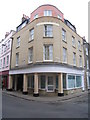
Daily life in CB2 1TJ is enriched by a mix of retail, leisure, and recreational amenities. The area is within walking distance of five retail outlets, including Sainsburys Sidney, M&S Cambridge, and Tesco Petty, providing convenience for shopping and dining. Three railway stations—Cambridge North, Shelford, and Waterbeach—offer easy access to the city’s cultural and commercial centres. Recreational spaces like Lammas Land and Grantchester Meadows are nearby, offering historical and natural landscapes for leisure. The area also includes St Mark’s Church on Barton Road, a community landmark. This blend of practical amenities and green spaces supports a lifestyle that balances urban convenience with access to nature and heritage.
Amenities
Schools
The area is served by two independent schools: King’s College School and St John’s College School. Both are private institutions, offering education to students from pre-school through to secondary levels. The presence of independent schools suggests a community that values academic excellence and may cater to families seeking alternative educational pathways. While no Ofsted ratings are provided, the selection of independent schools aligns with Cambridge’s reputation as a hub for elite education. These institutions likely contribute to the area’s appeal for professionals and academics, though they may also reflect a higher cost of living associated with private schooling.
| Rank | School | Type | Entry gender | Ages |
|---|
Explore more schools in this area
Go to Schools tabDemographics
The population of CB2 1TJ is overwhelmingly young, with 57% of residents aged 15–29, reflecting a median age of 22. This demographic skew suggests a community driven by students, graduates, and early-career professionals. Home ownership stands at 57%, with houses being the predominant accommodation type, indicating a mix of established residents and those seeking long-term stability. The area’s ethnic composition is predominantly White, though specific diversity metrics are not detailed in the data. The high population density—1,510 people per square kilometre—means the area is compact but not overcrowded, with a focus on residential living. While no deprivation data is provided, the presence of independent schools and retail amenities suggests a relatively well-served community, though the young age profile may imply a transient population.
Household Size
Accommodation Type
Tenure
Ethnic Group
Religion
Household Composition
Age
Household Deprivation
NS-SEC
Explore more demographic insights in this area
Go to Demographics tabPlanning
Planning Constraints
- Flood RiskPremium
- Ramsar Wetland SitesPremium
- Area of Outstanding Natural BeautyPremium
- Protected Nature ReservePremium
- Protected WoodlandPremium