Area Overview for CB2 1RL
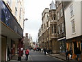
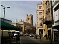
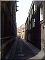
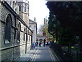
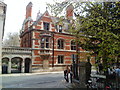
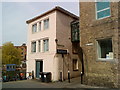
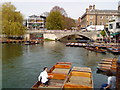
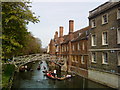
Photos of CB2 1RL
Area Information
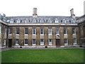
Living in CB2 1RL, a small residential cluster in Cambridge, England, offers a blend of historical significance and modern convenience. The area spans 7,584 m² and is home to 5,735 residents, creating a dense yet compact community with a population density of 1,510 people per km². Historically, this area was part of Newnham, a ward with roots in the 13th century, shaped by its proximity to the River Cam and its role as a former agricultural hub. Today, it lies partly within Cambridge and partly in Grantchester, offering a mix of suburban tranquillity and access to the city’s amenities. Daily life here is influenced by its location near educational institutions, with a young population skewing towards adults aged 15–29. The area’s compact size means amenities are within practical reach, while its low crime risk and lack of environmental constraints make it appealing for families and professionals alike.
- Area Type
- Postcode
- Area Size
- 7584 m²
- Population
- 5735
- Population Density
- 1510 people/km²
The property market in CB2 1RL is characterised by a 57% home ownership rate, with houses forming the majority of the accommodation stock. This suggests a community where many residents are long-term homeowners, likely drawn by the area’s compact size and proximity to amenities. Given the small area size and limited data on property types, the housing stock is likely to be a mix of older, family homes and newer developments. The lack of rental market statistics means it is unclear whether the area is more suited to owner-occupiers or investors. For buyers, the small postcode area means properties are closely clustered, potentially limiting choice but ensuring proximity to schools, transport, and green spaces. The absence of planning constraints also makes it an attractive option for those seeking straightforward property transactions.
House Prices in CB2 1RL
Showing 13 properties
Energy Efficiency in CB2 1RL
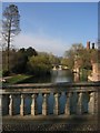
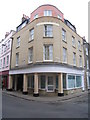
Residents of CB2 1RL have access to a range of amenities within practical reach. Retail options include Tesco Petty and M&S Cambridge, providing everyday shopping needs. The area’s rail stations connect to Cambridge North, Shelford, and Waterbeach, offering easy access to the city and surrounding towns. Recreational spaces such as Lammas Land and Grantchester Meadows, mentioned in historical research, provide green spaces for walking, cycling, or relaxation. These areas have historical significance, with Lammas Land originally serving as common land for grazing. The nearby St Mark’s Church on Barton Road adds to the area’s character, while the proximity to Cambridge Airport ensures travel convenience. The mix of retail, transport, and open spaces creates a lifestyle that balances urban accessibility with suburban comfort.
Amenities
Schools
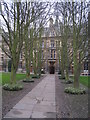
Residents of CB2 1RL have access to two independent schools: King’s College School and St John’s College School. Both are private institutions, offering alternative educational pathways for families seeking non-state schooling. The presence of two independent schools suggests a demand for high-quality, fee-paying education in the area, though no Ofsted ratings are provided to assess their performance. For families prioritising private education, this proximity to two institutions could be a significant advantage. However, the lack of state school data means it is unclear whether the area also supports public education options. The mix of school types may cater to a range of preferences, from academic rigor to specialist curricula, depending on the institutions’ focus.
| Rank | School | Type | Entry gender | Ages |
|---|
Explore more schools in this area
Go to Schools tabDemographics
CB2 1RL has a median age of 22, with the majority of residents falling into the 15–29 age bracket. This reflects a community dominated by young adults, likely students or early-career professionals. Home ownership stands at 57%, with houses being the predominant accommodation type. The population is predominantly White, though specific diversity metrics are not detailed. The high proportion of young residents suggests a dynamic, transient population, potentially influenced by nearby educational institutions. The area’s density and age profile indicate a mix of student housing and starter homes, with limited data on deprivation levels. For those prioritising affordability, the 57% ownership rate suggests a balance between rental and owner-occupied properties, though the exact proportion of renters is not specified.
Household Size
Accommodation Type
Tenure
Ethnic Group
Religion
Household Composition
Age
Household Deprivation
NS-SEC
Explore more demographic insights in this area
Go to Demographics tabPlanning
Planning Constraints
- Flood RiskPremium
- Ramsar Wetland SitesPremium
- Area of Outstanding Natural BeautyPremium
- Protected Nature ReservePremium
- Protected WoodlandPremium