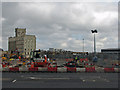
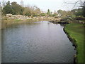
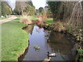
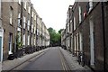
Area Overview for CB2 1JR
Photos of CB2 1JR

Area Information
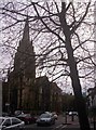
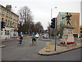
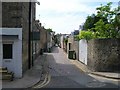
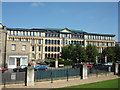
Living in CB2 1JR means being part of a tightly knit residential cluster in central Cambridge, where history and modernity intersect. The area covers 3,710 square metres and is home to 1,819 residents, making it one of the most densely populated postcode areas in England. Its proximity to the historic marketplace and the Church of St Mary the Great underscores its central role in Cambridge’s urban fabric. Daily life here is shaped by the compact layout, with amenities and services within easy reach. The area’s small size means a strong sense of community, though the high population density can create a bustling atmosphere. For those seeking a blend of heritage and convenience, CB2 1JR offers a unique position near key landmarks, including the city’s historic core, while remaining within reach of modern infrastructure like rail links and retail hubs. Its location also ensures access to Cambridge’s broader cultural and educational offerings, making it a practical choice for professionals and families alike.
- Area Type
- Postcode
- Area Size
- 3710 m²
- Population
- Not available
- Population Density
- Not available
The property market in CB2 1JR is defined by its high density and limited space, with flats making up the vast majority of the housing stock. At 35% home ownership, the area leans more towards a rental market than owner-occupation, which is typical for small, urban postcode areas. The compact nature of the cluster means that property availability is constrained, and buyers may find fewer options compared to larger suburbs. For those considering the area, the prevalence of flats suggests a focus on convenience and proximity to services, though the small size of the postcode means that immediate surroundings—such as nearby wards—may offer more varied housing types. The high population density also implies that demand for properties here is likely to be strong, particularly for those prioritising central Cambridge’s amenities over larger living spaces.
House Prices in CB2 1JR
Showing 1 properties
| Address | Type | Beds | Baths | Last Sale Price | Last Sale Date | |
|---|---|---|---|---|---|---|
| The Catholic Rectory, Hills Road, Cambridge, CB2 1JR | Detached | - | - | - | - |
Energy Efficiency in CB2 1JR
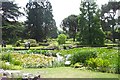
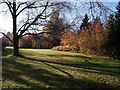
The lifestyle in CB2 1JR is shaped by its proximity to essential amenities and services. Residents have access to five retail outlets, including Co-op Hills and Sainsburys Cambridge St, ensuring everyday shopping needs are met without long journeys. The area’s rail links to Cambridge North, Shelford, and Waterbeach stations provide convenient access to the city’s broader transport network, while the nearby airports—both named Cambridge Airport—add to the region’s connectivity. Though the area itself is small, its location within central Cambridge means that cultural, leisure, and professional opportunities are readily available. The compact layout fosters a sense of convenience, though it may also mean that larger parks or recreational spaces are located further afield.
Amenities
Schools
Residents of CB2 1JR have access to a range of educational options, including state and independent schools. St Pauls CofE VA Primary School and St Alban’s Catholic Primary School are both state-funded institutions with a ‘good’ Ofsted rating, offering families reliable primary education. For independent schooling, St Mary’s School, The Leys School, and Sancton Wood School provide alternative choices, though their specific ratings are not listed. The mix of school types allows parents flexibility, whether they prioritise faith-based education, independent curricula, or state-run institutions. The proximity of these schools to the area suggests that families with children are well-served, though the small size of CB2 1JR means that school catchment areas may extend into adjacent postcode regions.
| Rank | School | Type | Entry gender | Ages |
|---|
Explore more schools in this area
Go to Schools tabDemographics
The community in CB2 1JR is predominantly middle-aged, with a median age of 47 and the majority of residents falling within the 30–64 age range. Home ownership here is relatively low, with only 35% of properties owner-occupied, suggesting a higher proportion of rental dwellings. The accommodation type is almost exclusively flats, reflecting the area’s compact footprint and historical development patterns. The predominant ethnic group is White, though no specific diversity statistics are provided. The population density of 490,292 people per square kilometre is exceptionally high, which may influence the character of daily life, with a focus on shared spaces and communal living. This density also means that services and amenities are closely clustered, though it may contribute to a more intense urban environment compared to less populated areas.
Household Size
Accommodation Type
Tenure
Ethnic Group
Religion
Household Composition
Age
Household Deprivation
NS-SEC
Explore more demographic insights in this area
Go to Demographics tabPlanning
Planning Constraints
- Flood RiskPremium
- Ramsar Wetland SitesPremium
- Area of Outstanding Natural BeautyPremium
- Protected Nature ReservePremium
- Protected WoodlandPremium