Area Overview for CB11 4QU
Photos of CB11 4QU
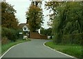
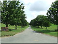
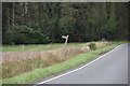
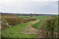
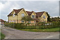
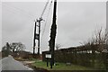
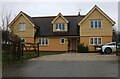
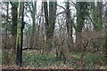
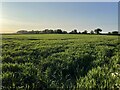
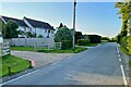
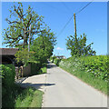
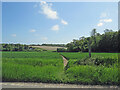
23 photos from this area
Area Information
Key information about the CB11 4QU including its size, population, and administrative classification.
- Area Type
- Postcode
- Area Size
- 27.5 hectares
- Population
- 1574
- Population Density
- 83 people/km²
House Prices in CB11 4QU
51
Properties
£686,105
Average Sold Price
£100,000
Lowest Price
£1,201,001
Highest Price
Showing 51 properties
| Address | Type | Beds | Baths | Last Sale Price | Last Sale Date | |
|---|---|---|---|---|---|---|
| The Clays, Clatterbury Lane, Clavering, CB11 4QU | Detached | 3 | 2 | £750,000 | Sep 2025 | |
| Camlea, Clatterbury Lane, Clavering, CB11 4QU | Detached | 5 | 3 | £987,500 | Jul 2025 | |
| Willow Cottage, Clatterbury Lane, Clavering, CB11 4QU | Semi-detached | 4 | 2 | £675,000 | Nov 2024 | |
| Oakwood, Clatterbury Lane, Clavering, CB11 4QU | house | - | - | £945,000 | Jun 2023 | |
| Farthings, Clatterbury Lane, Clavering, CB11 4QU | Detached | 5 | 3 | £960,000 | Mar 2023 | |
| Pond Cottage, Clatterbury Lane, Clavering, CB11 4QU | house | 3 | - | £600,000 | Nov 2019 | |
| Kemps Cottage, Clatterbury Lane, Clavering, CB11 4QU | house | - | - | £760,000 | Aug 2018 | |
| Belmont, Clatterbury Lane, Clavering, CB11 4QU | house | 3 | - | £950,000 | Oct 2016 | |
| Eastwood, Clatterbury Lane, Clavering, CB11 4QU | Detached | 6 | 3 | £630,000 | Aug 2014 | |
| Burroughs, Clatterbury Lane, Clavering, CB11 4QU | house | - | - | £1,090,000 | May 2014 |
Page 1 of 6
Energy Efficiency in CB11 4QU
Amenities
Schools
| Rank | School | Type | Entry gender | Ages |
|---|
Explore more schools in this area
Go to Schools tabDemographics
Household Size
Two person
most common
Accommodation Type
Houses
most common
Tenure
82
majority
Ethnic Group
White
most common
Religion
N/A
most common
Household Composition
N/A
most common
Age
47
median
Adults (30-64 years)
most common
Household Deprivation
N/A
with no deprivation
NS-SEC
47
in Lower managerial occupations
Explore more demographic insights in this area
Go to Demographics tabPlanning
Planning Constraints
- Flood RiskPremium
- Ramsar Wetland SitesPremium
- Area of Outstanding Natural BeautyPremium
- Protected Nature ReservePremium
- Protected WoodlandPremium