Area Overview for CB11 4DN
Photos of CB11 4DN

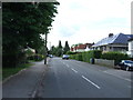


30 photos from this area
Area Information
Key information about the CB11 4DN including its size, population, and administrative classification.
- Area Type
- Postcode
- Area Size
- 9.7 hectares
- Population
- 1486
- Population Density
- 653 people/km²
House Prices in CB11 4DN
50
Properties
£181,782
Average Sold Price
£65,500
Lowest Price
£357,500
Highest Price
Showing 50 properties
| Address | Type | Beds | Baths | Last Sale Price | Last Sale Date | |
|---|---|---|---|---|---|---|
| 102 Loompits Way, Saffron Walden, CB11 4DN | Terraced | 2 | 1 | £315,000 | Sep 2025 | |
| 51 Loompits Way, Saffron Walden, CB11 4DN | house | 2 | 1 | £310,000 | Dec 2024 | |
| 67 Loompits Way, Saffron Walden, CB11 4DN | Terraced | 1 | 1 | £220,000 | Sep 2024 | |
| 112 Loompits Way, Saffron Walden, CB11 4DN | Terraced | 2 | 1 | £240,000 | Apr 2024 | |
| 87 Loompits Way, Saffron Walden, CB11 4DN | Semi-detached | 2 | - | £313,700 | Aug 2023 | |
| 93 Loompits Way, Saffron Walden, CB11 4DN | Semi-detached | 1 | 1 | £219,000 | Aug 2023 | |
| 84 Loompits Way, Saffron Walden, CB11 4DN | house | 2 | 1 | £198,000 | Jan 2023 | |
| 109 Loompits Way, Saffron Walden, CB11 4DN | Semi-detached | 3 | - | £357,500 | Sep 2022 | |
| 97 Loompits Way, Saffron Walden, CB11 4DN | Terraced | 2 | 1 | £312,000 | Sep 2022 | |
| 118 Loompits Way, Saffron Walden, CB11 4DN | Terraced | 1 | 1 | £206,000 | Apr 2022 |
Page 1 of 5
Energy Efficiency in CB11 4DN
Amenities
Schools
| Rank | School | Type | Entry gender | Ages |
|---|
Explore more schools in this area
Go to Schools tabDemographics
Household Size
Family (3-5 people)
most common
Accommodation Type
Houses
most common
Tenure
55
majority
Ethnic Group
White
most common
Religion
N/A
most common
Household Composition
N/A
most common
Age
47
median
Adults (30-64 years)
most common
Household Deprivation
N/A
with no deprivation
NS-SEC
39
in Lower managerial occupations
Explore more demographic insights in this area
Go to Demographics tabPlanning
Planning Constraints
- Flood RiskPremium
- Ramsar Wetland SitesPremium
- Area of Outstanding Natural BeautyPremium
- Protected Nature ReservePremium
- Protected WoodlandPremium