Area Overview for CB11 4BH
Photos of CB11 4BH
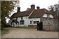
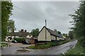
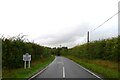
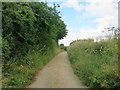
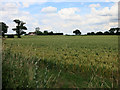
11 photos from this area
Area Information
Key information about the CB11 4BH including its size, population, and administrative classification.
- Area Type
- Postcode
- Area Size
- 4.6 hectares
- Population
- 2269
- Population Density
- 885 people/km²
House Prices in CB11 4BH
53
Properties
£126,510
Average Sold Price
£34,500
Lowest Price
£360,000
Highest Price
Showing 53 properties
| Address | Type | Beds | Baths | Last Sale Price | Last Sale Date | |
|---|---|---|---|---|---|---|
| 58 Ozier Court, Saffron Walden, CB11 4BH | Flat | - | - | £173,500 | Jun 2024 | |
| 21 Ozier Court, Saffron Walden, CB11 4BH | Terraced | 3 | 1 | £360,000 | Nov 2023 | |
| 25 Ozier Court, Saffron Walden, CB11 4BH | Terraced | 3 | 1 | £320,000 | Jul 2023 | |
| 14 Ozier Court, Saffron Walden, CB11 4BH | Flat | 2 | - | £175,000 | Mar 2023 | |
| 18 Ozier Court, Saffron Walden, CB11 4BH | Flat | - | - | £126,000 | Feb 2023 | |
| 56 Ozier Court, Saffron Walden, CB11 4BH | Flat | 2 | 1 | £120,000 | Mar 2022 | |
| 54 Ozier Court, Saffron Walden, CB11 4BH | Flat | - | - | £113,000 | Jul 2021 | |
| 62 Ozier Court, Saffron Walden, CB11 4BH | Flat | 1 | - | £132,500 | May 2021 | |
| 13 Ozier Court, Saffron Walden, CB11 4BH | house | - | - | £353,500 | Jan 2021 | |
| 27 Ozier Court, Saffron Walden, CB11 4BH | Terraced | 3 | 1 | £249,000 | Oct 2020 |
Page 1 of 6
Energy Efficiency in CB11 4BH
Amenities
Schools
| Rank | School | Type | Entry gender | Ages |
|---|
Explore more schools in this area
Go to Schools tabDemographics
Household Size
Family (3-5 people)
most common
Accommodation Type
Houses
most common
Tenure
77
majority
Ethnic Group
White
most common
Religion
N/A
most common
Household Composition
N/A
most common
Age
47
median
Adults (30-64 years)
most common
Household Deprivation
N/A
with no deprivation
NS-SEC
43
in Lower managerial occupations
Explore more demographic insights in this area
Go to Demographics tabPlanning
Planning Constraints
- Flood RiskPremium
- Ramsar Wetland SitesPremium
- Area of Outstanding Natural BeautyPremium
- Protected Nature ReservePremium
- Protected WoodlandPremium