Area Overview for CB11 3ZR
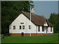
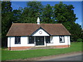
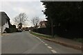
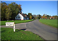
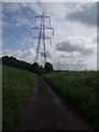
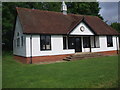
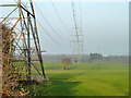
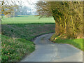
Photos of CB11 3ZR
Area Information
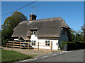
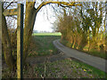
Living in CB11 3ZR means being part of a small, rural parish in Essex that blends historic charm with modern convenience. The area, covering a compact cluster of homes near Quendon and Rickling, has a population of 2,073, with a low density of 93 people per square kilometre. This makes it a quiet, close-knit community with a strong sense of local identity. The village lies along the B1383 road, between Saffron Walden and Bishop’s Stortford, and is served by nearby railway stations and London Stansted Airport. Historic features include 17th-century houses, a village green, and churches dating back over 800 years. Daily life here is shaped by rural traditions, with active clubs, a village hall, and summer cricket matches. The area’s character is defined by its preserved heritage, from flint and brick homes to listed buildings like Quendon Hall. For those seeking a peaceful, community-focused lifestyle with easy access to transport and amenities, CB11 3ZR offers a distinctive blend of history and practicality.
- Area Type
- Postcode
- Area Size
- Not available
- Population
- 2073
- Population Density
- 93 people/km²
The property market in CB11 3ZR is dominated by owner-occupied homes, with 79% of properties owned by residents rather than rented. The accommodation type is primarily houses, reflecting the area’s rural and historic character. This contrasts with urban areas where flats and apartments are more common. The small population and limited housing stock mean the market is niche, with properties likely to be family homes or larger residences suited to the area’s low density. Buyers should consider the proximity to amenities like schools, transport links, and the village green, which enhance the appeal of owning a home here. The focus on houses rather than rental properties suggests a market driven by long-term residency rather than short-term investment. Those seeking a property in CB11 3ZR may find a mix of characterful homes with historical features, though the small size of the area means competition for available listings could be limited.
House Prices in CB11 3ZR
No properties found in this postcode.
Energy Efficiency in CB11 3ZR
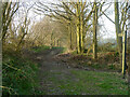
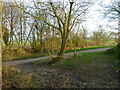
The lifestyle in CB11 3ZR is defined by its rural charm and accessible amenities. Residents can enjoy the village green at Rickling Green, a historic space used for community events and leisure. Nearby shops include Spar and Tesco outlets, providing essentials without the need to travel far. The area’s character is enriched by its heritage, with historic houses, churches, and sites like Quendon Hall. The village hall and active clubs foster social connections, while summer cricket matches and the Coffin Path bridleway offer recreational opportunities. The presence of a primary school and nearby railway stations adds practicality, ensuring families and commuters have what they need. This blend of tradition and convenience creates a lifestyle that feels both rooted in history and adaptable to modern living, making it appealing for those who value community and accessibility.
Amenities
Schools
The nearest school to CB11 3ZR is Rickling Church of England Voluntary Aided Primary School, which serves the local community with a good Ofsted rating. This primary school is a key asset for families, offering a solid foundation for early education. The absence of secondary schools in the immediate area means parents may need to look further afield for secondary education, but the primary school’s quality suggests a strong start for children. The school’s presence also reinforces the area’s community feel, with events and activities likely to involve local families. Given the area’s small size and focus on historic living, the school plays a central role in shaping the local environment. For those prioritising educational quality, the good rating at Rickling Primary indicates a reliable option for younger children, though secondary schooling remains a consideration for long-term planning.
| Rank | School | Type | Entry gender | Ages |
|---|
Explore more schools in this area
Go to Schools tabDemographics
The community in CB11 3ZR is predominantly middle-aged, with a median age of 47 and the most common age range being adults aged 30–64. Home ownership is high, at 79%, reflecting a stable, long-term resident base. The area is largely composed of houses, not flats, which aligns with its rural character and traditional housing stock. The predominant ethnic group is White, with no specific data on other demographics provided. The population size and age profile suggest a community focused on family life and local engagement. With a low population density, the area maintains a relaxed, uncluttered atmosphere. The absence of significant deprivation data implies a generally stable quality of life, though the small population means limited diversity in social or cultural offerings. This demographic profile supports a tight-knit, familiar environment where community ties are strong.
Household Size
Accommodation Type
Tenure
Ethnic Group
Religion
Household Composition
Age
Household Deprivation
NS-SEC
Explore more demographic insights in this area
Go to Demographics tabPlanning
Planning Constraints
- Flood RiskPremium
- Ramsar Wetland SitesPremium
- Area of Outstanding Natural BeautyPremium
- Protected Nature ReservePremium
- Protected WoodlandPremium