Area Overview for CB11 3PL
Photos of CB11 3PL
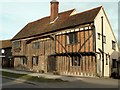
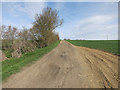
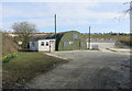
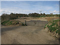

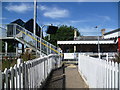

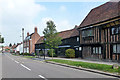
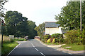
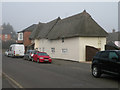
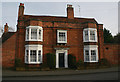
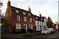
100 photos from this area
Area Information
Key information about the CB11 3PL including its size, population, and administrative classification.
- Area Type
- Postcode
- Area Size
- 1.9 hectares
- Population
- 2073
- Population Density
- 93 people/km²
House Prices in CB11 3PL
16
Properties
£467,278
Average Sold Price
£130,000
Lowest Price
£940,000
Highest Price
Showing 16 properties
| Address | Type | Beds | Baths | Last Sale Price | Last Sale Date | |
|---|---|---|---|---|---|---|
| Roseberry House, Station Road, Newport, CB11 3PL | house | 4 | 3 | £640,000 | Oct 2025 | |
| 3 Station Road, Newport, CB11 3PL | Semi-detached | 2 | 1 | £360,275 | May 2025 | |
| Berwyn House, Station Road, Newport, CB11 3PL | Semi-detached | 4 | 3 | £695,000 | Mar 2025 | |
| Middle House, Station Road, Newport, CB11 3PL | Terraced | 4 | 2 | £685,000 | Dec 2024 | |
| Granta House, Station Road, Newport, CB11 3PL | Semi-detached | - | - | £940,000 | Feb 2021 | |
| Station House, Station Road, Newport, CB11 3PL | house | - | - | £302,500 | Dec 2018 | |
| 2 Station Road, Newport, CB11 3PL | Semi-detached | 2 | 1 | £215,000 | Jan 2012 | |
| Bank House, Station Road, Newport, CB11 3PL | house | - | - | £355,000 | Dec 2006 | |
| Tuskers, Station Road, Newport, CB11 3PL | Detached | 4 | - | £350,000 | Jan 2006 | |
| Saxon House, Station Road, Newport, CB11 3PL | Detached | - | - | £130,000 | Jul 2001 |
Page 1 of 2
Energy Efficiency in CB11 3PL
Amenities
Schools
| Rank | School | Type | Entry gender | Ages |
|---|
Explore more schools in this area
Go to Schools tabDemographics
Household Size
Family (3-5 people)
most common
Accommodation Type
Houses
most common
Tenure
79
majority
Ethnic Group
White
most common
Religion
N/A
most common
Household Composition
N/A
most common
Age
47
median
Adults (30-64 years)
most common
Household Deprivation
N/A
with no deprivation
NS-SEC
49
in Lower managerial occupations
Explore more demographic insights in this area
Go to Demographics tabPlanning
Planning Constraints
- Flood RiskPremium
- Ramsar Wetland SitesPremium
- Area of Outstanding Natural BeautyPremium
- Protected Nature ReservePremium
- Protected WoodlandPremium