Area Overview for CB10 2QT
Photos of CB10 2QT
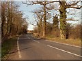
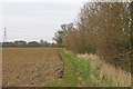
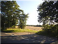
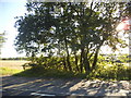


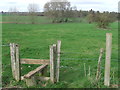
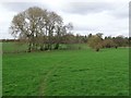


10 photos from this area
Area Information
Key information about the CB10 2QT including its size, population, and administrative classification.
- Area Type
- Postcode
- Area Size
- 85.4 hectares
- Population
- 1939
- Population Density
- 39 people/km²
House Prices in CB10 2QT
16
Properties
£956,667
Average Sold Price
£740,000
Lowest Price
£1,345,000
Highest Price
Showing 16 properties
| Address | Type | Beds | Baths | Last Sale Price | Last Sale Date | |
|---|---|---|---|---|---|---|
| Tawneys, Finchingfield Road, Little Sampford, CB10 2QT | Detached | 5 | 3 | £785,000 | Dec 2025 | |
| Barley Croft, Finchingfield Road, Little Sampford, CB10 2QT | Detached | 5 | 3 | £740,000 | Oct 2018 | |
| The Old Rectory, Finchingfield Road, Little Sampford, CB10 2QT | Detached | 7 | - | £1,345,000 | Dec 2016 | |
| The Grange, Finchingfield Road, Little Sampford, CB10 2QT | Detached | 8 | 3 | - | - | |
| The Brook, Finchingfield Road, Little Sampford, CB10 2QT | Detached | 4 | 2 | - | - | |
| Annexe At, Tawneys, Finchingfield Road, Little Sampford, CB10 2QT | Detached | 5 | 3 | - | - | |
| The Ashes, Finchingfield Road, Little Sampford, CB10 2QT | Detached | 5 | 3 | - | - | |
| Mill House, Finchingfield Road, Little Sampford, CB10 2QT | Detached | 2 | 2 | - | - | |
| Rectory Cottage, Finchingfield Road, Little Sampford, CB10 2QT | Detached | 4 | 2 | - | - | |
| Formerly Known As Tawneys, Finchingfield Road, Little Sampford, CB10 2QT | undefined | - | - | - | - |
Page 1 of 2
Energy Efficiency in CB10 2QT
Amenities
Schools
| Rank | School | Type | Entry gender | Ages |
|---|
Explore more schools in this area
Go to Schools tabDemographics
Household Size
Two person
most common
Accommodation Type
Houses
most common
Tenure
79
majority
Ethnic Group
White
most common
Religion
N/A
most common
Household Composition
N/A
most common
Age
47
median
Adults (30-64 years)
most common
Household Deprivation
N/A
with no deprivation
NS-SEC
45
in Lower managerial occupations
Explore more demographic insights in this area
Go to Demographics tabPlanning
Planning Constraints
- Flood RiskPremium
- Ramsar Wetland SitesPremium
- Area of Outstanding Natural BeautyPremium
- Protected Nature ReservePremium
- Protected WoodlandPremium