Area Overview for CB10 2NY
Photos of CB10 2NY
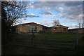
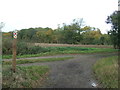
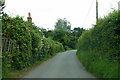
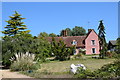
9 photos from this area
Area Information
Key information about the CB10 2NY including its size, population, and administrative classification.
- Area Type
- Postcode
- Area Size
- 2.7 km²
- Population
- 1939
- Population Density
- 39 people/km²
House Prices in CB10 2NY
25
Properties
£604,667
Average Sold Price
£275,000
Lowest Price
£935,000
Highest Price
Showing 25 properties
| Address | Type | Beds | Baths | Last Sale Price | Last Sale Date | |
|---|---|---|---|---|---|---|
| Seddlewood Farm, Howe Lane, Great Sampford, CB10 2NY | Detached | - | - | £925,000 | Aug 2014 | |
| Old Barn House, Howe Lane, Great Sampford, CB10 2NY | Detached | 5 | 4 | £935,000 | Sep 2013 | |
| Portways, Howe Lane, Great Sampford, CB10 2NY | house | 5 | - | £598,000 | Nov 2012 | |
| The Cottage, Howe Lane, Great Sampford, CB10 2NY | house | - | - | £275,000 | Nov 2012 | |
| Bean Pods, Howe Lane, Great Sampford, CB10 2NY | Detached | 4 | - | £320,000 | Nov 2003 | |
| Calthorpes Farm, Howe Lane, Great Sampford, CB10 2NY | house | - | - | £575,000 | Oct 1999 | |
| Roselea, Howe Lane, Great Sampford, CB10 2NY | Detached | 5 | 3 | - | - | |
| Free Roberts Barn, Free Roberts, Howe Lane, Great Sampford, CB10 2NY | Semi-detached | 5 | 5 | - | - | |
| Cabbages, Howe Lane, Great Sampford, CB10 2NY | Detached | 4 | 2 | - | - | |
| Sorrells Farmhouse, Howe Lane, Great Sampford, CB10 2NY | Detached | - | - | - | - |
Page 1 of 3
Energy Efficiency in CB10 2NY
Amenities
Schools
| Rank | School | Type | Entry gender | Ages |
|---|
Explore more schools in this area
Go to Schools tabDemographics
Household Size
Two person
most common
Accommodation Type
Houses
most common
Tenure
79
majority
Ethnic Group
White
most common
Religion
N/A
most common
Household Composition
N/A
most common
Age
47
median
Adults (30-64 years)
most common
Household Deprivation
N/A
with no deprivation
NS-SEC
45
in Lower managerial occupations
Explore more demographic insights in this area
Go to Demographics tabPlanning
Planning Constraints
- Flood RiskPremium
- Ramsar Wetland SitesPremium
- Area of Outstanding Natural BeautyPremium
- Protected Nature ReservePremium
- Protected WoodlandPremium