Area Overview for CB10 2NQ
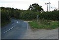
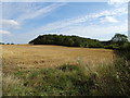
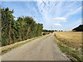
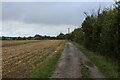
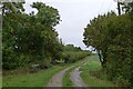
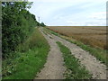
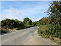
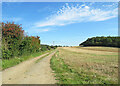
Photos of CB10 2NQ
Area Information
Living in CB10 2NQ means being part of a small, tightly knit residential cluster in the historic market town of Saffron Walden, Essex. The area spans 16 hectares and is home to 2,057 residents, giving it a population density of 149 people per square kilometre. This postcode sits in a region shaped by centuries of market activity, wool trade, and saffron cultivation, which lent the town its name. Daily life here balances rural tranquillity with proximity to services, with the area’s compact size ensuring residents are never far from amenities. The community is predominantly middle-aged, with a median age of 47, and many households are owner-occupied, reflecting a stable, long-term presence. The surrounding landscape includes historic landmarks like the 15th-century St Mary the Virgin Parish Church and the 14-acre Common, offering a blend of heritage and green space. CB10 2NQ is ideal for those seeking a quieter lifestyle without sacrificing access to transport, retail, and cultural attractions.
- Area Type
- Postcode
- Area Size
- 16.0 hectares
- Population
- 2057
- Population Density
- 149 people/km²
The property market in CB10 2NQ is defined by a high rate of home ownership (74%) and a predominance of houses as the primary accommodation type. This suggests a market where long-term residents are more likely than renters to own their homes, reflecting the area’s stability and appeal to established households. The small size of the postcode area (16 hectares) means the housing stock is limited, which could create competition among buyers. The focus on houses rather than flats or apartments indicates a preference for private, detached living, which may align with the rural character of Saffron Walden. For buyers, this means properties are likely to be of higher value and more spacious, but the limited supply could mean fewer options. Proximity to nearby rail stations and historic amenities may further enhance the area’s desirability, though the small size of the postcode means buyers must consider surrounding areas for more choices.
House Prices in CB10 2NQ
No properties found in this postcode.
Energy Efficiency in CB10 2NQ
Residents of CB10 2NQ have access to a range of practical amenities within reach. The nearby retail options include Tesco Saffron, Waitrose Saffron, and Aldi Saffron, providing a mix of grocery and convenience shopping. These stores cater to daily needs, ensuring residents can manage household tasks without long journeys. The area’s proximity to three rail stations—Audley End, Great Chesterford, and Newport—adds to its convenience, offering easy access to regional transport. While the data does not list specific leisure or dining venues, the historic character of Saffron Walden itself—home to landmarks like the Common and Audley End House—suggests a blend of cultural and recreational opportunities. The combination of retail, transport, and historical sites contributes to a lifestyle that balances practicality with a connection to the area’s heritage.
Amenities
Schools
The nearest school to CB10 2NQ is Dame Bradbury’s School, an independent institution. This school is part of a small selection of educational options in the area, with no state schools listed in the data. The presence of an independent school suggests that families prioritising private education may find this area appealing, though those seeking state-funded options would need to look beyond the immediate vicinity. The lack of diversity in school types could be a consideration for parents, as it limits choices for different educational preferences or budgets. However, the proximity of Dame Bradbury’s School to the postcode means residents have direct access to a reputable independent institution, which may be a key factor for families prioritising private schooling.
| Rank | School | Type | Entry gender | Ages |
|---|
Explore more schools in this area
Go to Schools tabDemographics
The community in CB10 2NQ is characterised by a median age of 47, with the majority of residents falling within the 30-64 age range. This suggests a population skewed towards adults in their prime working years, likely contributing to the area’s stable economic profile. Home ownership is high, at 74%, indicating a strong presence of long-term residents rather than transient renters. The accommodation type is predominantly houses, which aligns with the area’s residential character and lower population density. The predominant ethnic group is White, reflecting the broader demographic trends in rural Essex. With a population of 2,057 spread over 16 hectares, the area maintains a low density that fosters a close-knit community feel. This demographic profile suggests a mature, settled population with established roots, which may influence local services and amenities tailored to adult needs rather than those of children or younger families.
Household Size
Accommodation Type
Tenure
Ethnic Group
Religion
Household Composition
Age
Household Deprivation
NS-SEC
Explore more demographic insights in this area
Go to Demographics tabPlanning
Planning Constraints
- Flood RiskPremium
- Ramsar Wetland SitesPremium
- Area of Outstanding Natural BeautyPremium
- Protected Nature ReservePremium
- Protected WoodlandPremium