Area Overview for CB10 2FL
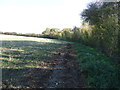
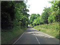
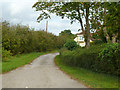
Photos of CB10 2FL
Area Information
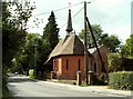
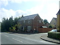
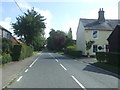
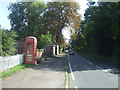
Living in CB10 2FL means being part of Sewards End, a small rural village in Essex’s Uttlesford district. This postcode covers a compact residential cluster, with a population of 1,749 spread over a low-density area of 55 people per square kilometre. Historically a civil parish since 2004, the village retains its rural character, defined by historic architecture and a shift from traditional industries to commuter lifestyles. Located just 2 miles east of Saffron Walden, it blends quiet village life with proximity to nearby towns. Residents benefit from a mix of local amenities, including a thriving village hall and parish church, alongside modern conveniences like nearby rail links. The area’s charm lies in its low population density, which fosters a close-knit community feel, while its strategic location offers easy access to larger urban centres. For those seeking a peaceful, low-traffic environment with a strong sense of local identity, CB10 2FL presents a distinctive option.
- Area Type
- Postcode
- Area Size
- Not available
- Population
- 1749
- Population Density
- 55 people/km²
CB10 2FL is a predominantly owner-occupied area, with 79% of properties owned by residents rather than rented. The accommodation type is largely houses, which is typical for rural and semi-rural postcodes. This suggests a housing stock that includes family homes, larger properties, and possibly some historic or characterful buildings. The low population density and focus on houses indicate a market geared toward long-term residency rather than short-term rentals or high-density development. For buyers, this means a limited number of properties available, with a strong emphasis on private ownership. The area’s small size and proximity to Saffron Walden may also mean that property values are influenced by the broader regional market. Buyers should consider the potential for limited competition but also the importance of local amenities and transport links when evaluating properties in this area.
House Prices in CB10 2FL
No properties found in this postcode.
Energy Efficiency in CB10 2FL
Residents of CB10 2FL have access to five retail outlets within the area, including major chains like Tesco Saffron, Aldi Saffron, and Waitrose Saffron. These shops provide convenience for daily shopping, reducing the need to travel further afield. The presence of three railway stations—Audley End, Newport, and Great Chesterford—enhances mobility, connecting the village to nearby towns and cities. While the area lacks large-scale leisure facilities, the village hall and historic buildings contribute to a community-focused lifestyle. The low population density and rural setting mean a quieter, more relaxed environment, ideal for those seeking a balance between convenience and tranquillity. The mix of local shops and transport links ensures that daily life remains practical, with easy access to both essential services and broader regional networks.
Amenities
Schools
The nearest school to CB10 2FL is Ashdon Primary School, a primary institution with a ‘good’ Ofsted rating. This school serves the local community and is likely a key consideration for families with young children. The absence of secondary schools in the immediate area means residents may need to look to nearby towns like Saffron Walden for secondary education. The single primary school suggests a focused, community-based approach to early education, though families may need to plan for commuting to higher levels of schooling. The ‘good’ rating indicates a reliable standard of teaching and facilities, which is reassuring for parents seeking quality education for their children.
| Rank | School | Type | Entry gender | Ages |
|---|
Explore more schools in this area
Go to Schools tabDemographics
The population of CB10 2FL is predominantly adults aged 30–64, with a median age of 47. This reflects a mature, stable community, where 79% of residents own their homes. The accommodation type is primarily houses, suggesting a mix of family homes and larger properties. The predominant ethnic group is White, aligning with broader regional trends. The low population density of 55 people per square kilometre indicates a spread-out, less congested living environment. While no specific deprivation data is provided, the high home ownership rate and mature age profile suggest a community with established roots and long-term residency. This demographic profile implies a focus on stability, with limited turnover of residents. The absence of detailed diversity metrics means the area’s social fabric is largely defined by its dominant demographic group, though the village’s character is enriched by its historic and rural context.
Household Size
Accommodation Type
Tenure
Ethnic Group
Religion
Household Composition
Age
Household Deprivation
NS-SEC
Explore more demographic insights in this area
Go to Demographics tabPlanning
Planning Constraints
- Flood RiskPremium
- Ramsar Wetland SitesPremium
- Area of Outstanding Natural BeautyPremium
- Protected Nature ReservePremium
- Protected WoodlandPremium