Area Overview for CB10 1UE
Photos of CB10 1UE
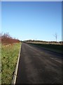
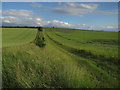
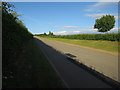
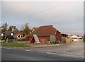
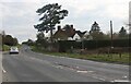
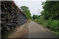
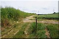
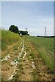
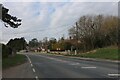
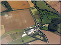
11 photos from this area
Area Information
Key information about the CB10 1UE including its size, population, and administrative classification.
- Area Type
- Postcode
- Area Size
- 1.2 km²
- Population
- 1988
- Population Density
- 113 people/km²
House Prices in CB10 1UE
12
Properties
£536,667
Average Sold Price
£305,000
Lowest Price
£795,000
Highest Price
Showing 12 properties
| Address | Type | Beds | Baths | Last Sale Price | Last Sale Date | |
|---|---|---|---|---|---|---|
| Wakefield Farm, Walden Road, Little Chesterford, CB10 1UE | Detached | - | - | £795,000 | Sep 2021 | |
| The Coach House Springwell Place, Walden Road, Little Chesterford, CB10 1UE | Detached | 4 | 2 | £510,000 | Aug 2020 | |
| Springwell Cottage, Walden Road, Little Chesterford, CB10 1UE | Detached | 3 | - | £305,000 | Sep 2014 | |
| Joseph Farm, Walden Road, Little Chesterford, CB10 1UE | Detached | 5 | 4 | - | - | |
| Springwell Stables, Walden Road, Little Chesterford, CB10 1UE | Detached | 4 | - | - | - | |
| Springwell Place, Walden Road, Little Chesterford, CB10 1UE | Detached | 6 | - | - | - | |
| Plot 1, Joseph Farm, Walden Road, Little Chesterford, CB10 1UE | Semi-detached | - | - | - | - | |
| Josephs Farm, Walden Road, Little Chesterford, CB10 1UE | undefined | - | - | - | - | |
| Joseph Farm Springwell, Walden Road, Little Chesterford, CB10 1UE | undefined | - | - | - | - | |
| Springwell Stud Farm, Walden Road, Little Chesterford, CB10 1UE | Detached | - | - | - | - |
Page 1 of 2
Energy Efficiency in CB10 1UE
Amenities
Schools
| Rank | School | Type | Entry gender | Ages |
|---|
Explore more schools in this area
Go to Schools tabDemographics
Household Size
Family (3-5 people)
most common
Accommodation Type
Houses
most common
Tenure
76
majority
Ethnic Group
White
most common
Religion
N/A
most common
Household Composition
N/A
most common
Age
47
median
Adults (30-64 years)
most common
Household Deprivation
N/A
with no deprivation
NS-SEC
54
in Lower managerial occupations
Explore more demographic insights in this area
Go to Demographics tabPlanning
Planning Constraints
- Flood RiskPremium
- Ramsar Wetland SitesPremium
- Area of Outstanding Natural BeautyPremium
- Protected Nature ReservePremium
- Protected WoodlandPremium