Area Overview for CB10 1QB
Photos of CB10 1QB
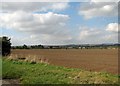
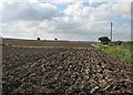
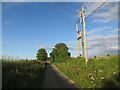

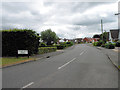
35 photos from this area
Area Information
Key information about the CB10 1QB including its size, population, and administrative classification.
- Area Type
- Postcode
- Area Size
- 3.2 hectares
- Population
- 1988
- Population Density
- 113 people/km²
House Prices in CB10 1QB
63
Properties
£455,748
Average Sold Price
£103,000
Lowest Price
£750,000
Highest Price
Showing 63 properties
| Address | Type | Beds | Baths | Last Sale Price | Last Sale Date | |
|---|---|---|---|---|---|---|
| 54 Stanley Road, Great Chesterford, CB10 1QB | house | - | - | £450,000 | Nov 2024 | |
| 3 Stanley Road, Great Chesterford, CB10 1QB | Bungalow | 3 | 1 | £442,500 | Mar 2024 | |
| 15 Stanley Road, Great Chesterford, CB10 1QB | Bungalow | 3 | 1 | £430,000 | Nov 2023 | |
| 49 Stanley Road, Great Chesterford, CB10 1QB | Detached | 3 | - | £550,000 | Jan 2023 | |
| 59 Stanley Road, Great Chesterford, CB10 1QB | Detached | 5 | 3 | £750,000 | Nov 2022 | |
| 44 Stanley Road, Great Chesterford, CB10 1QB | Semi-detached | 3 | 2 | £542,000 | Nov 2022 | |
| 42 Stanley Road, Great Chesterford, CB10 1QB | Semi-detached | 3 | 2 | £507,500 | Aug 2022 | |
| 63 Stanley Road, Great Chesterford, CB10 1QB | house | - | - | £512,500 | Dec 2021 | |
| 6 Stanley Road, Great Chesterford, CB10 1QB | house | - | - | £565,000 | Jun 2021 | |
| 51 Stanley Road, Great Chesterford, CB10 1QB | house | - | - | £700,001 | Jun 2021 |
Page 1 of 7
Energy Efficiency in CB10 1QB
Amenities
Schools
| Rank | School | Type | Entry gender | Ages |
|---|
Explore more schools in this area
Go to Schools tabDemographics
Household Size
Family (3-5 people)
most common
Accommodation Type
Houses
most common
Tenure
76
majority
Ethnic Group
White
most common
Religion
N/A
most common
Household Composition
N/A
most common
Age
47
median
Adults (30-64 years)
most common
Household Deprivation
N/A
with no deprivation
NS-SEC
54
in Lower managerial occupations
Explore more demographic insights in this area
Go to Demographics tabPlanning
Planning Constraints
- Flood RiskPremium
- Ramsar Wetland SitesPremium
- Area of Outstanding Natural BeautyPremium
- Protected Nature ReservePremium
- Protected WoodlandPremium