Area Overview for CB1 9PT
Photos of CB1 9PT


Area Information
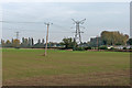
CB1 9PT is a small residential postcode area in Cambridge, Cambridgeshire, encompassing part of the village of Cherry Hinton. With a population of 1,451 and a density of 913 people per square kilometre, it reflects a compact, closely knit community. Historically, Cherry Hinton was two settlements—Church End and Mill End—that merged in the 19th century after railway development and land drainage. The name "Cherry Hinton" dates to the mid-1500s, derived from the abundant cherry trees that once thrived here. Today, the area blends suburban living with historical charm, featuring landmarks like St Andrew’s Church, which dates to the 12th century, and Cherry Hinton Hall, a public park and event venue. Residents benefit from proximity to Cambridge’s urban amenities while retaining a village character. The area’s compact size means daily life is walkable, with local shops, schools, and transport links within easy reach. Its mix of older and newer housing, combined with low crime rates and excellent broadband, makes it appealing to families and professionals seeking a balanced lifestyle.
- Area Type
- Postcode
- Area Size
- Not available
- Population
- 1451
- Population Density
- 913 people/km²
The property market in CB1 9PT is characterised by a 41% home ownership rate, with houses being the predominant accommodation type. This suggests a suburban landscape where detached or semi-detached homes are more common than flats or apartments. The relatively low home ownership percentage indicates that a significant portion of the housing stock may be rented, potentially attracting a mix of long-term residents and transient occupants. Given the area’s small size, the housing stock is limited, which may influence property prices and availability. Buyers should consider that the market is likely to be competitive, with demand driven by proximity to Cambridge’s amenities and the area’s low crime rate. The presence of houses rather than high-density housing also aligns with a preference for family-friendly living. For those seeking investment, the area’s stability and infrastructure make it a viable option, though the limited size means opportunities are constrained to the immediate vicinity.
House Prices in CB1 9PT
Showing 1 properties
| Address | Type | Beds | Baths | Last Sale Price | Last Sale Date | |
|---|---|---|---|---|---|---|
| Arm 6, 100 Fulbourn Road, Cambridge, CB1 9PT | Office | - | - | - | - |
Energy Efficiency in CB1 9PT
Residents of CB1 9PT have access to a range of amenities within practical reach. Retail options include Tesco Cherry, Morrisons Daily, and Tesco Cambridge, offering everyday shopping needs. The area’s proximity to multiple railway stations and two airports enhances connectivity, supporting both local and long-distance travel. Nearby leisure facilities include Cherry Hinton Hall, a public park with a paddling pool, tennis courts, and event hosting, and St Andrew’s Church, a historic site with cultural significance. The village green at Church End provides a traditional communal space. These amenities contribute to a lifestyle that balances convenience with historical and recreational value. The presence of shops, transport hubs, and green spaces ensures daily life is both practical and enriched by local character.
Amenities
Schools
The nearest school to CB1 9PT is Colville Primary School, a primary institution with a good Ofsted rating. This provides families with access to a well-regarded early education option, though no secondary schools are listed in the data. The presence of a primary school with a positive rating supports the area’s appeal to families, ensuring children have a quality start to their education. However, parents seeking secondary schooling may need to look beyond the immediate area, as no local secondary schools are noted. The single school listed reflects the small scale of the community, where educational provision is focused on primary needs. For those prioritising proximity to schools, Colville Primary’s good rating is a key advantage, though the lack of secondary options should be considered in broader housing decisions.
| Rank | School | Type | Entry gender | Ages |
|---|
Explore more schools in this area
Go to Schools tabDemographics
The population of CB1 9PT has a median age of 47, with the majority of residents aged 30–64. This suggests a mature, stable community with a strong presence of middle-aged households. Home ownership accounts for 41% of properties, indicating a mix of owner-occupied homes and rental units. The primary accommodation type is houses, reflecting a suburban rather than high-density residential profile. The predominant ethnic group is White, though no specific data on diversity beyond this is provided. The age profile implies a focus on family life and long-term residency, with fewer young or elderly residents compared to other areas. This demographic structure supports a quiet, established neighbourhood where local amenities and community ties are likely to be well developed. The absence of specific deprivation data means the area’s socioeconomic challenges cannot be assessed, but the low crime score and good broadband access suggest a generally stable environment.
Household Size
Accommodation Type
Tenure
Ethnic Group
Religion
Household Composition
Age
Household Deprivation
NS-SEC
Explore more demographic insights in this area
Go to Demographics tabPlanning
Planning Constraints
- Flood RiskPremium
- Ramsar Wetland SitesPremium
- Area of Outstanding Natural BeautyPremium
- Protected Nature ReservePremium
- Protected WoodlandPremium