Area Overview for CB1 6PH
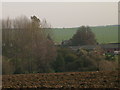
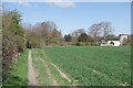
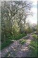
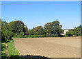
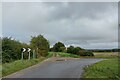
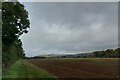
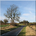
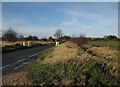
Photos of CB1 6PH

Area Information
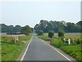
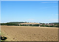
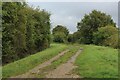
Living in CB1 6PH means inhabiting a small, rural postcode area in Cambridgeshire, straddling the border with Essex. With a population of 1,749 and a density of 55 people per square kilometre, this is a quiet, low-density community. The area’s character is shaped by its ancient roots, including St Botolph’s Church, a cruciform structure dating to the 11th century and listed in the Domesday Book. Residents benefit from a mix of rural tranquillity and proximity to Cambridge, just 10 miles north-west. The village of Hadstock, where CB1 6PH is located, retains a historic charm, with features like Hadstock Hall and a former windmill. Daily life here is likely to be slow-paced, with a focus on local amenities and community ties. The area’s small size means residents are close to nature, with agricultural landscapes and historic sites nearby. For those seeking a peaceful, historic setting with easy access to a major city, CB1 6PH offers a unique blend of rural and regional connectivity.
- Area Type
- Postcode
- Area Size
- Not available
- Population
- 1749
- Population Density
- 55 people/km²
The property market in CB1 6PH is dominated by owner-occupied homes, with 79% of properties owned by residents rather than rented. The accommodation type is primarily houses, reflecting a rural, low-density settlement typical of small villages. This suggests a market where properties are likely to be larger, with gardens and more space than urban areas. The small size of the postcode area means the housing stock is limited, and buyers may need to consider nearby towns for additional options. The high home ownership rate indicates a stable market with fewer rental properties, which could be appealing to buyers seeking long-term investment or family homes. However, the limited number of properties may also mean competition for available listings. For those prioritising space, privacy, and a historic setting, CB1 6PH offers a niche market with distinct character.
House Prices in CB1 6PH
No properties found in this postcode.
Energy Efficiency in CB1 6PH
Residents of CB1 6PH have access to five retail outlets within practical reach, including Co-op Linton, Spar – Abington Stores &, and Tesco Saffron. These shops provide everyday essentials, from groceries to general goods, reducing the need for long trips. The area’s small size means amenities are concentrated, with local shops and railway stations serving as focal points for daily life. The nearby railway stations also offer access to broader networks, enabling trips to Cambridge or other towns for dining, shopping, or cultural activities. The presence of these amenities suggests a self-contained but connected community. While the data does not mention parks or leisure facilities, the rural setting likely includes open spaces for walking or recreation. The combination of local shops and transport links supports a convenient, low-maintenance lifestyle.
Amenities
Schools
The nearest school to CB1 6PH is Ashdon Primary School, a primary institution with a good Ofsted rating. This school serves the local community, providing education for younger children in the area. The absence of secondary schools or other educational institutions in the immediate vicinity means families may need to look to nearby towns for secondary education. However, the good rating at Ashdon Primary School suggests a reliable foundation for early learning. For parents prioritising quality primary education, the proximity of this school is a key advantage. The single school listed in the data indicates a focus on primary-level schooling, with no mention of further educational facilities within the area. Families should consider transport options to access secondary schools in larger towns like Saffron Walden or Cambridge.
| Rank | School | Type | Entry gender | Ages |
|---|
Explore more schools in this area
Go to Schools tabDemographics
The community in CB1 6PH is predominantly middle-aged, with a median age of 47 and the most common age range being adults aged 30–64. Home ownership is high at 79%, indicating a stable, long-term resident base. The area is largely composed of houses, reflecting a traditional, family-oriented housing stock. The predominant ethnic group is White, though specific data on diversity or minority representation is not provided. The low population density of 55 people per square kilometre suggests a spread-out, less crowded living environment. This demographic profile implies a community focused on established families and individuals seeking a settled lifestyle. The absence of specific deprivation data means no direct conclusions can be drawn about economic challenges, but the high home ownership rate and age profile suggest a relatively affluent, stable area.
Household Size
Accommodation Type
Tenure
Ethnic Group
Religion
Household Composition
Age
Household Deprivation
NS-SEC
Explore more demographic insights in this area
Go to Demographics tabPlanning
Planning Constraints
- Flood RiskPremium
- Ramsar Wetland SitesPremium
- Area of Outstanding Natural BeautyPremium
- Protected Nature ReservePremium
- Protected WoodlandPremium