Area Overview for Castledon & Crouch Ward
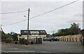
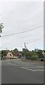
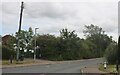
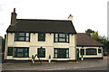
Photos of Castledon & Crouch Ward
Area Information
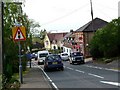
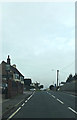
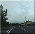
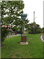
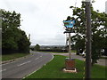
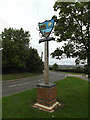
Castledon and Crouch Ward represents a distinct microcosm within the Borough of Wakefield, distinguished by its compact scale and established residential character. This district covers an area of 16.1 square kilometres, creating a densely populated yet manageable environment with a total population of 1,427 residents. A population density of 89 people per square kilometre suggests a settled community where neighbours are familiar with one another, without the overwhelming intensity of a major urban centre. Living in Castledon and Crouch Ward offers a specific lifestyle defined by this moderate density, which supports a quiet daily existence while maintaining proximity to local amenities. You will find that daily life here revolves around a close-knit demographic, as evidenced by the area's composition. The ward is situated in England, providing a streamline connection to wider regional services while retaining a strong local identity. The combination of limited square footage and a fixed population count indicates that capacity for expansion is low, making existing homes highly stable assets. Prospective buyers entering this market are looking at an established footprint rather than a developing zone. The area's boundaries are clear, defined by these precise geographical metrics, which helps in understanding the true extent of the neighbourhood you are considering for your home.
- Area Type
- District Borough Unitary Ward
- Area Size
- 16.1 km²
- Population
- 1427
- Population Density
- 89 people/km²
Demographics
The community profile of Castledon and Crouch Ward reflects a mature, settled population with a median age of 70 years. This demographic skews significantly older than the national average, indicating that the ward is predominantly retired or senior living. You can expect a household composition characterised by individuals who have stayed in their homes for decades, contributing to a high sense of local continuity. The most prominent age group consists of seniors, which shapes the pace and priorities of life in this specific part of Wakefield. Home ownership stands as a defining feature of this neighbourhood, with 82 per cent of residents owning their properties outright or with a mortgage. This figure suggests that the local market is driven by homeowners making strategic decisions rather than transient renters moving frequently. Accommodation types within the ward likely reflect long-term tenure, often comprising bungalows or single-storey homes suited to the age profile of the inhabitants. While specific ethnic group and religious data are not detailed in the current assessment, the social fabric is tightly woven around the needs of an older demographic. Understanding these age-related needs is essential when viewing any homes in Castledon and Crouch Ward, as the infrastructure and local services are tailored to this mature population.
Household Size
Accommodation Type
Tenure
Ethnic Group
Religion
Household Composition
Age
Household Deprivation
NS-SEC
Explore more demographic insights in this area
Go to Demographics tabPlanning
Planning Constraints
- Flood RiskPremium
- Ramsar Wetland SitesPremium
- Area of Outstanding Natural BeautyPremium
- Protected Nature ReservePremium