Area Overview for Carlton Colville
Photos of Carlton Colville


Area Information
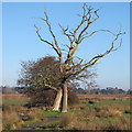
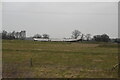
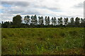
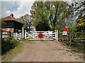
Carlton Colville is a civil parish situated in England, covering a distinct area of 8.4 km². It represents a specialised settlement where daily life revolves around a quiet, established rhythm rather than rapid urban development. Living in Carlton Colville means prioritising space and community cohesion over the immediate proximity of city centres. The parish functions as a self-contained locality, offering residents a defined boundary within which they organise their routines. This small footprint creates a close-knit environment where neighbours know one another, distinguishing it from sprawling urban districts. Prospective buyers appreciate the clarity of its boundaries and the settled nature of its surroundings. The area does not boast extensive amenities or large commercial hubs within its limits, but instead relies on its intimate scale. Every element of the parish, from housing to green spaces, fits within this manageable 8.4 km² expanse. This concentration fosters a sense of familiarity that defines the local experience. Homebuyers often seek Carlton Colville for the predictability it offers in terms of community structure and scale. It stands as a clear example of a focused rural settlement where the land and the people exist in balance. The area's identity is firmly rooted in its status as a functional parish rather than a bustling town centre.
- Area Type
- District Borough Unitary Ward
- Area Size
- 8.4 km²
- Population
- Not available
- Population Density
- Not available
Demographics
The community in Carlton Colville displays a very specific demographic profile that reflects its long-standing character. A decisive median age of 70 years indicates that elderly residents form the core of the population. This high average age suggests a community where many households consist of older adults who have chosen to settle permanently. The most common age range statistic confirms that the majority of residents fall into the broader elderly demographic, shaping social interactions and local services. Home ownership reaches an impressive level of 79%, meaning the vast majority of people living in Carlton Colville own their properties outright or with a substantial mortgage. This figure highlights a deep sense of stability and attachment to the locality. Household composition data reflects this settlement pattern, showing that families and individuals tend to remain in the same homes for extended periods. Accommodation types mirror this longevity, with a steady stock of dwellings designed for established residents. The area lacks significant transient populations or high levels of transient tenancy. Diversity records indicate the ethnic composition is homogeneous, aligning with the traditional nature of many older English parishes. Religious affiliation follows similar patterns, with the predominant group reflecting long-term cultural norms. This demographic consistency provides a predictable environment for new arrivals seeking to understand the local way of life.
Household Size
Accommodation Type
Tenure
Ethnic Group
Religion
Household Composition
Age
Household Deprivation
NS-SEC
Explore more demographic insights in this area
Go to Demographics tabPlanning
Planning Constraints
- Flood RiskPremium
- Ramsar Wetland SitesPremium
- Area of Outstanding Natural BeautyPremium
- Protected Nature ReservePremium
- Protected WoodlandPremium
- Crime RiskPremium