Area Overview for Carleton St. Peter
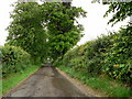
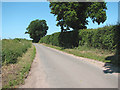
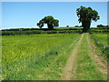
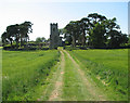
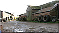
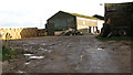
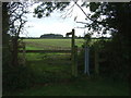
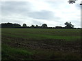
Photos of Carleton St. Peter
Area Information
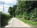
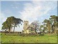
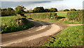
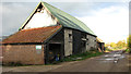
Living in Carleton St. Peter offers a defined sense of place within a civil parish covering 3.2 km². This small area sits away from major urban sprawl, presenting a distinct rural character for those seeking a specific lifestyle. You will find that daily life here revolves around local amenities and the quiet pace typical of its size. The community is characterised by a strong emphasis on home ownership, which shapes how residents interact with their neighbourhood and property values. As you explore homes in Carleton St. Peter, you encounter an environment where the built environment blends with the surrounding landscape. The parish does not fall under the protection of an Area of Outstanding Natural Beauty, meaning planning rules operate under standard county guidelines. However, the presence of protected woodland within the parish boundaries indicates that nature conservation remains a priority for the local planning framework. You can expect a setting where the physical constraints of the land coexist with the residential needs of the population. The area supports a demographic that has settled for the long term. This stability creates a predictable routine for anyone considering moving to the parish. The median age reflects this historical settlement pattern, distinguishing it from areas with higher transient populations. When you imagine life here, picture a community where neighbours know one another and the rhythm of the day follows local traditions. The scale of the parish ensures that facilities remain focused on immediate needs rather than large-scale commercial developments. Your experience of living in Carleton St. Peter will be grounded in this specific, manageable footprint.
- Area Type
- Parish
- Area Size
- 3.2 km²
- Population
- Not available
- Population Density
- Not available
Demographics
The community in Carleton St. Peter is defined by a significantly older population profile. Data shows a median age of 70, indicating that the area attracts retirees or residents who have lived here for decades. This age distribution suggests that the lifestyle here accommodates those seeking a slower pace with mature surroundings rather than a dynamic, youthful environment. You should be aware that the most common age grouping totals across all categories when specific ranges are not subdivided, reinforcing the broad demographic spread. Home ownership stands as the dominant feature of this neighbourhood, with 85% of residents owning their homes outright or with a mortgage. This high level of stability implies a community rooted deeply in the local area. Flexible ownership models are less common than traditional freehold or leasehold arrangements for this population. Consequently, households in Carleton St. Peter tend to be permanent rather than transient. The household composition reflects this stability, with families often structured around long-term residency patterns. You will not find specific ethnic group data provided for this parish in current records, so discussions of diversity remain based on the total population figures available. Similarly, detailed breakdowns of religion or specific household types lack granular separation in the available information. Instead, the total household composition serves as the primary metric for understanding the area. This focus on aggregate data highlights the cohesive, uniform nature of the residential stock. Whether you have special housing needs or prefer established communities, the 85% ownership rate creates a supportive environment for long-term living arrangements.
Household Size
Accommodation Type
Tenure
Ethnic Group
Religion
Household Composition
Age
Household Deprivation
NS-SEC
Explore more demographic insights in this area
Go to Demographics tabPlanning
Planning Constraints
- Flood RiskPremium
- Area of Outstanding Natural BeautyPremium
- Protected WoodlandPremium
- Crime RiskPremium