Area Overview for Carbrooke
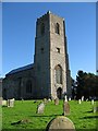
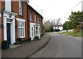
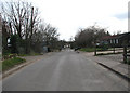
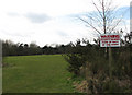
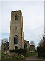
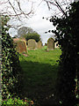
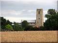
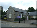
Photos of Carbrooke
Area Information
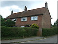
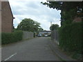
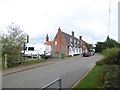
Carbrooke is a compact built-up area in England, spanning 35.7 hectares. Its small size means residents have easy access to local amenities and a tight-knit community feel. The area’s median age of 70 suggests a predominantly older population, which may influence the pace of daily life and the types of services available. Living here offers proximity to essential retail, including Spar, Lidl Watton, and Tesco Watton, all within practical reach. The presence of two primary schools—St Peter and St Paul Church of England Voluntary Controlled Primary School and St Peter and St Paul Church of England Primary Academy & Nursery—highlights the area’s focus on education. While Carbrooke lacks large-scale infrastructure, its quiet, low-traffic environment and below-average crime rates make it appealing for those prioritising safety and simplicity. For buyers, the 79% home ownership rate indicates a stable, long-term resident base, with properties likely to hold value. However, the area’s small size and older demographic may limit opportunities for younger families seeking dynamic, growing communities.
- Area Type
- Built Up Area 250
- Area Size
- 35.7 hectares
- Population
- Not available
- Population Density
- Not available
Carbrooke’s lifestyle is shaped by its proximity to essential retail outlets, including Spar, Lidl Watton, and Tesco Watton. These shops provide convenience for daily errands, from groceries to household supplies, reducing the need for long trips to larger towns. The absence of detailed data on dining, parks, or leisure facilities means the area’s recreational options are not specified, but the presence of multiple retail stores suggests a focus on practicality over luxury. Residents may rely on nearby towns for more diverse entertainment or green spaces. The small size of Carbrooke means amenities are tightly clustered, fostering a self-contained environment where most needs can be met within walking or short driving distance. This convenience is balanced by the limited scope for larger-scale leisure or cultural activities.
Amenities
Schools
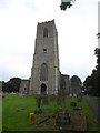
Carbrooke is served by two primary schools: St Peter and St Paul Church of England Voluntary Controlled Primary School and St Peter and St Paul Church of England Primary Academy & Nursery. Both institutions cater to younger children, with the latter receiving a ‘good’ Ofsted rating, indicating a strong educational standard. The presence of two primary schools within the area provides parents with options for their children’s early education, though no secondary schools are listed in the data. This focus on primary education may appeal to families prioritising early learning but could necessitate travel for secondary schooling. The schools’ church-affiliated status may also align with residents’ religious preferences, though the broader community’s diversity is not specified.
| Rank | A + A* % | School | Type | Entry gender | Ages |
|---|---|---|---|---|---|
| 1 | N/A | St Peter and St Paul Church of England Voluntary Controlled Primary School | primary | N/A | N/A |
| 2 | N/A | St Peter and St Paul Church of England Primary Academy & Nursery | primary | N/A | N/A |
Explore more schools in this area
Go to Schools tabDemographics
Carbrooke’s population is defined by its median age of 70, the highest in the dataset, suggesting a community dominated by older adults. This age profile may influence local services, with healthcare and leisure facilities tailored to senior needs. The 79% home ownership rate indicates most residents live in owner-occupied properties, which can contribute to a sense of permanence. However, the data does not specify household composition or accommodation types, so it is unclear whether the area includes a mix of family homes, flats, or single-occupancy units. The absence of details on ethnic diversity or religious composition means broader demographic trends remain unexplored. For buyers, the high median age may signal a quieter, less transient environment, though it could also mean limited demand for larger homes or family-oriented amenities.
Household Size
Accommodation Type
Tenure
Ethnic Group
Religion
Household Composition
Age
Household Deprivation
NS-SEC
Explore more demographic insights in this area
Go to Demographics tabPlanning
Planning Constraints
- Crime RiskLocked