Area Overview for Cantley
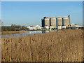
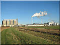
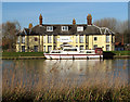
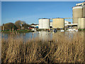
Photos of Cantley

Area Information
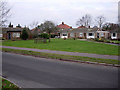
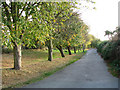
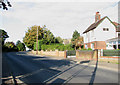
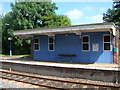
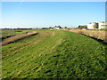
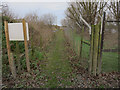
Cantley is a compact built-up area in England, spanning 67.1 hectares. Its population, while not explicitly stated, is reflected in its median age of 70, suggesting a community skewed towards older residents. This demographic profile shapes the area’s character, with daily life centred on local amenities and proximity to transport links. Cantley’s appeal lies in its practicality: nearby rail stations, including Cantley Railway Station and Reedham Railway Station, offer regular connections to surrounding towns, while Reedham Ferry North provides access to water-based travel. The presence of Cantley Primary School, rated 'good' by Ofsted, adds to the area’s appeal for families. Despite its modest size, Cantley balances accessibility with a sense of quiet stability, making it a viable choice for those prioritising convenience over urban vibrancy.
- Area Type
- Built Up Area 250
- Area Size
- 67.1 hectares
- Population
- Not available
- Population Density
- Not available
Residents of Cantley have access to a range of nearby amenities, including five retail outlets such as Spar, Co-op Loddon, and East of England Co-operative Co. These shops provide essential services and everyday convenience. The presence of multiple rail stations and a ferry service suggests a practical approach to connectivity, allowing residents to travel efficiently for work, leisure, or shopping. While the area lacks detailed information on parks or leisure facilities, the existing amenities contribute to a functional lifestyle. The mix of retail and transport options supports a self-contained daily routine, though those seeking more extensive recreational facilities may need to venture further afield.
Amenities
Schools
Cantley Primary School is the only named school listed in the area, catering to primary education. Its Ofsted rating of 'good' indicates a satisfactory standard of teaching and facilities. The absence of secondary schools in the data means families may need to look beyond Cantley for comprehensive schooling. However, the proximity of Cantley Primary School offers convenience for younger children. The single school listed suggests limited educational options, which could be a consideration for families prioritising a range of school types. Parents should evaluate whether the primary school’s quality meets their needs and whether additional schools are accessible nearby.
| Rank | School | Type | Entry gender | Ages |
|---|
Explore more schools in this area
Go to Schools tabDemographics
Cantley’s population is predominantly aged 70, with the most common age range encompassing all age groups. Home ownership in the area stands at 52%, indicating that nearly half of residents rent their homes. This figure suggests a community where rental properties may dominate, potentially influencing the local property market. Accommodation types and household composition are reported as 'total', offering no breakdown of specific housing stock or family structures. Ethnicity and religious diversity data are similarly aggregated, with no specific groups highlighted. The median age implies a mature demographic, which may affect local services and amenities. While no deprivation data is provided, the age profile could influence the demand for healthcare and community support services.
Household Size
Accommodation Type
Tenure
Ethnic Group
Religion
Household Composition
Age
Household Deprivation
NS-SEC
Explore more demographic insights in this area
Go to Demographics tabPlanning
Planning Constraints
- Crime RiskPremium