Area Overview for Canewdon
Photos of Canewdon


Area Information
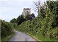
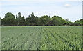
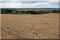
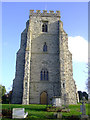
Canewdon is a built-up area situated in England, covering a total expanse of 57.6 hectares. This compact footprint defines a neighbourhood where residents experience a close-knit community environment. Living in Canewdon means you are part of a distinct locality that balances residential density with immediate access to surrounding facilities. The area functions as a practical homebase for families and individuals seeking a established settlement rather than a sprawling urban sprawl. Your daily routine benefits from proximity to key transport links and local retail options without the noise of a major city centre. The community character is shaped by its modest size, which fosters familiarity among neighbours. Homes here offer a sense of belonging within a defined geographic boundary that the local infrastructure supports. You live in a space designed for convenience, where essential services are reachable within short travel times. This setting provides stability and predictability for anyone choosing to make Canewdon their primary residence. The area stands as a functional part of the broader Essex landscape, offering specific advantages for those prioritising accessibility and quality of life. Choosing this location places you within a recognised residential zone that has developed its own distinct identity over time.
- Area Type
- Built Up Area 250
- Area Size
- 57.6 hectares
- Population
- Not available
- Population Density
- Not available
Your lifestyle in Canewdon is defined by practical convenience and a wide selection of nearby amenities. Within walking or short driving distance, you can access five retail outlets including Co-op Rochford, Morrisons Daily, and Sainsburys Rochford. These specific grocery stores and shops ensure you have everyday essentials at your fingertips without long journeys. Public transport options are equally diverse, with five railway stations including Althorne, Rochford, and North Fambridge located nearby. If boating is a hobby, the Wallasea Island Ferry Landing and Burnham Yacht Harbour offer two alternative water-based connections to explore. For those requiring air travel, Southend Airport and London Southend Airport provide two aviation options close to your doorstep. This density of amenities means you can handle most daily chores locally while retaining access to regional hubs. The availability of multiple shopping destinations prevents any single point of failure in your supply chain. You can walk to Co-op for morning runs or drive to Sainsburys for larger weekly shop. The variety of transport modes gives you choices based on weather, urgency, or preference rather than necessity alone.
Amenities
Schools
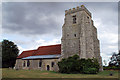
Living in Canewdon places you within reach of two specific primary educational establishments, both of which are Christian schools. Canewdon Endowed Church of England Voluntary Controlled Primary School serves the local community as its named institution. Additionally, Canewdon Church of England Primary School is situated nearby, providing another option for families. Both schools operate as voluntary controlled establishments, indicating their specific governance structure under the Church of England. The presence of two local primaries suggests that families often keep children in the neighbourhood until they reach secondary transfer age. You do not have comprehensive data on secondary schools or their Ofsted ratings within the provided information for this specific area. The mix of school types is currently limited to the primary sector in your immediate vicinity. For families with young children, these twin schools offer a direct educational path within Canewdon. The proximity of these venues means daily transport to school can be managed from within the borough. Prospective parents should verify the specific catchment zones and inspection reports for these two schools before finalising any property purchase decisions.
| Rank | School | Type | Entry gender | Ages |
|---|
Explore more schools in this area
Go to Schools tabDemographics
The demographic profile of Canewdon presents a clear picture of the housing consumer base. The median age in the area stands at 70 years, indicating a population skewed significantly towards older adults. This statistical reality shapes the local demand for housing and influences community activities. Approximately 78 per cent of households in Canewdon own their homes outright or with a mortgage, highlighting a strong tradition of home ownership rather than renting. This high ownership rate suggests long-term residents who have put down roots in the neighbourhood. The data indicates that the total population groups dominate the age distribution, reinforcing the prevalence of retirees and empty nesters. You are moving into an area where the social fabric is largely formed by older generations. The accommodation types reflect this demographic trend with a stock designed for established residents. Understanding these figures helps you anticipate who your neighbours might be and how the community operates throughout the year. The dominance of older age groups often correlates with stability and lower turnover rates in the local households.
Household Size
Accommodation Type
Tenure
Ethnic Group
Religion
Household Composition
Age
Household Deprivation
NS-SEC
Explore more demographic insights in this area
Go to Demographics tabPlanning
Planning Constraints
- Crime RiskPremium