Area Overview for Campton and Chicksands
Photos of Campton and Chicksands

Area Information
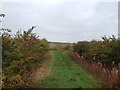
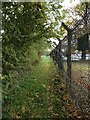
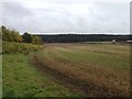
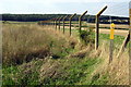
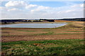
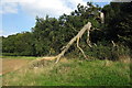
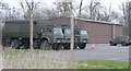
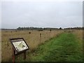
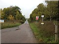
Campton and Chicksands sits as a civil parish within Central Bedfordshire, covering a specific footprint of 9.5 km². You will find the main settlements anchored at Campton and Chicksands, located about nine miles south of Bedford. The land lies in a low-lying area where geology defines the terrain with Woburn Sands Formation sandstone and Gault Formation mudstone from the Cretaceous Period. Elevations here range around 150 to 270 feet above sea level, creating a flat landscape for local residents. History shapes the current character, as the parish merged on 1 April 1985 following the contemporary parishes of Campton and Chicksands coming together. Campton was an ancient parish recorded in the Domesday Book of 1086 with eight households, while Chicksands became a civil parish in 1858 due to its association with Chicksands Priory. A significant population shift occurred mid-20th century when the Area hosted RAF Chicksands used by the American Air Force. Further boundary changes took place in 1993, refining the modern limits of the district. Living in Campton and Chicksands means navigating an area with roots stretching back nearly a thousand years alongside its more recent aviation history.
- Area Type
- Parish
- Area Size
- 9.5 km²
- Population
- Not available
- Population Density
- Not available
Demographics
The community profile reveals a mature population structure typical of this rural setting. The median age for residents stands at 70 years, indicating a predominantly older demographic. Data on the most common age range highlights that total population statistics drive this average, confirming a settlement where many families have moved into retirement. Home ownership remains the dominant living arrangement, with 72% of households owning their property outright or with a mortgage. This high level of ownership suggests stability within the neighbourhood, as most residents are not transient tenants. Household composition and accommodation type data reflect a broad spectrum of occupancy, though the ownership rate underscores a desire for long-term residence. While specific data on predominant ethnicity and religion are not detailed in the available figures, the high ownership rate and mature age profile provide clear context for who resides here. Living in Campton and Chicksands often means joining a community where neighbours have deep local ties and a shared commitment to the parish. The demographic reality shapes routine interactions, from local shop visits to participation in parish committee meetings. Understanding these age and ownership figures helps you gauge whether the community environment aligns with your lifestyle expectations.
Household Size
Accommodation Type
Tenure
Ethnic Group
Religion
Household Composition
Age
Household Deprivation
NS-SEC
Explore more demographic insights in this area
Go to Demographics tabPlanning
Planning Constraints
- Flood RiskPremium
- Ramsar Wetland SitesPremium
- Area of Outstanding Natural BeautyPremium
- Protected Nature ReservePremium
- Protected WoodlandPremium
- Crime RiskPremium