Area Overview for Callowland Ward
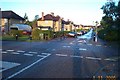
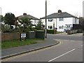
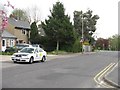
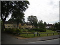
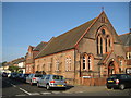
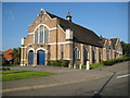
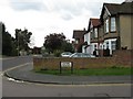
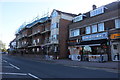
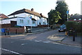
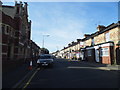
Photos of Callowland Ward
Area Information
Living in Callowland Ward offers a distinct residential experience within the Watford Borough of Hertfordshire. This electoral ward sprawls across 83.3 hectares, located approximately 15 miles northwest of central London. The area sits near the M1 and M25 motorway network, providing significant connectivity for commuters. Recent census data reveals a shifting population profile. The resident count reached 8,704 at the 2021 census, a notable increase from 7,444 in 2011 and 6,653 in 2001. This growth indicates a steadily expanding community. The ward boundaries encompass specific streets such as Osborne Road, Chiswellwood, and Balmoral Road. These locations form the core of daily life for current residents. The proximity to major transport links defines the practical utility of the location for those working in the capital or surrounding business hubs. You will find a neighbourhood that has undergone significant population shifts over the last two decades. The physical footprint remains substantial at 83.3 hectares, offering space for households while maintaining proximity to urban infrastructure. This combination of size and location makes Callowland Ward a specific choice for buyers seeking established connectivity.
- Area Type
- District Borough Unitary Ward
- Area Size
- 83.3 hectares
- Population
- Not available
- Population Density
- Not available
Demographics
The community within Callowland Ward displays a clear demographic concentration. The median age for residents is 70 years old. This suggests a significant proportion of the local population comprises older adults. Thirty-one per cent of the total population falls within the 69 to 74 age group. This specific age bracket represents the most common group living in the area. Within this cohort, the 79 to 84 year age group accounts for 23 per cent of residents. You may find a neighbourhood where daily life is dominated by this mature demographic. Home ownership stands at 51 per cent of households. This figure indicates a split market where owned and rented properties coexist. The ward contains 4,440 males and 4,266 females. This near-equal gender balance stabilises the household composition across the 83.3 hectares. The population density remains low compared to major urban centres, given the total ward population of 8,704. Buyers should expect a quiet environment where older generations form the heartbeat of the community. The data confirms a stable, mature grouping of residents rather than a rapidly changing family demographic.
Household Size
Accommodation Type
Tenure
Ethnic Group
Religion
Household Composition
Age
Household Deprivation
NS-SEC
Explore more demographic insights in this area
Go to Demographics tabPlanning
Planning Constraints
- Flood RiskPremium
- Ramsar Wetland SitesPremium
- Area of Outstanding Natural BeautyPremium
- Protected Nature ReservePremium
- Protected WoodlandPremium
- Crime RiskPremium