Area Overview for Caistor St. Edmund and Bixley
Photos of Caistor St. Edmund and Bixley

Area Information
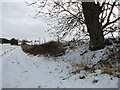
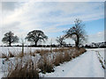
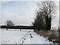
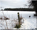
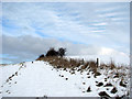
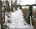
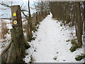
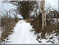
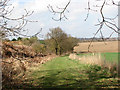
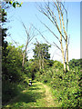
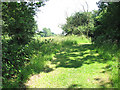
Caistor St. Edmund and Bixley stands as a distinct civil parish in Norfolk, covering an area of 11.9 km². Located approximately 4.0 km south of Norwich on the River Tas, the parish was formed on 1 April 2019 through the merger of Caistor St Edmund and Bixley. You will find two villages within these boundaries: Caistor St Edmund itself and the older village of Markshall. Living in Caistor St. Edmund and Bixley means navigating an area defined by deep historical roots. The name derives from the Roman town of Venta Icenorum and records ownership by Bury St Edmunds Abbey as documented in Domesday. Daily life here revolves around a landscape enriched by Neolithic henges at Arminghall, an Iron Age hill fort at Tasburgh, and the major Roman ruins of Venta Icenorum. These landmarks include a forum, basilica, and temple dating back to the AD 70s. The parish also contains Caistor Old Hall, built in 1612, and St Edmund's Church, which has remained in continuous use for over 950 years. Residents walk through an archaeologically significant site where Neolithic, Iron Age, and Roman layers coexist. The presence of two Chain Home Radar pylons from the Second World War also shapes the local skyline. When considering homes in Caistor St. Edmund and Bixley, you enter a community where modern life sits atop millennia of history, centred around these remarkable physical remains.
- Area Type
- Parish
- Area Size
- 11.9 km²
- Population
- Not available
- Population Density
- Not available
Demographics
The community in Caistor St. Edmund and Bixley has a clear demographic profile. The median age stands at 70 years, indicating an older population structure compared to many parts of the UK. There is a notable concentration of residents in the older age brackets. Home ownership levels are high, with 75% of households owning their properties outright or with a mortgage. This contrasts with rental markets, suggesting a stable, long-term community where residents put down deep roots. The parish does not provide specific breakdowns for household composition, predominant ethnic groups, or religious affiliation in the current data. Because the average age is 70, families with young children are less common than empty nesters or retired couples. You will encounter a neighbourhood where neighbours have lived there for decades. The high rate of home ownership reflects this stability, as owners rarely move every few years. This dynamic differs from areas with transient populations. The lack of specific data on ethnicity and religion means you cannot determine the precise mix of cultures present, but the age profile strongly suggests a retirement-oriented or older demographic. If you seek a quiet place to settle without the noise of a busy town centre, the age structure of Caistor St. Edmund and Bixley supports that lifestyle.
Household Size
Accommodation Type
Tenure
Ethnic Group
Religion
Household Composition
Age
Household Deprivation
NS-SEC
Explore more demographic insights in this area
Go to Demographics tabPlanning
Planning Constraints
- Flood RiskPremium
- Ramsar Wetland SitesPremium
- Area of Outstanding Natural BeautyPremium
- Protected Nature ReservePremium
- Protected WoodlandPremium
- Crime RiskPremium