Area Overview for Caister-on-Sea
Photos of Caister-on-Sea


Area Information
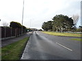
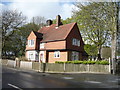
Living in Caister-on-Sea defines itself by its compact physical footprint and established coastal character. The built-up area spans just 2.9 km², creating a dense settlement that feels intimate rather than sprawling. You will find a community where daily journeys are short because essential services sit within practical reach. This town functions as a distinct residential hub where the immediate surroundings dictate the pace of life. The environment offers a setting where proximity to amenities reduces the need for extensive travel planning. Residents experience a settlement where distance between home and daily conveniences remains minimal. The small geographic scale means you navigate a concentrated neighbourhood rather than a dispersed urban sprawl. This layout supports a lifestyle where the local environment plays a central role in everyday routines. You live in a place where the boundary between home and community amenities is virtually non-existent. The area maintains its identity as a self-contained town with a clear focus on local integration.
- Area Type
- Built Up Area 250
- Area Size
- 2.9 km²
- Population
- Not available
- Population Density
- Not available
Your lifestyle in Caister-on-Sea revolves around a curated list of practical amenities located within practical reach. You have immediate access to five retail stores, including Lidl Caister-on, East of England Co-operative Co, and Tesco Great. These supermarkets provide you with the essentials for cooking food at home or grabbing last-minute groceries. For rail travel, Great Yarmouth Railway Station and Berney Arms Railway Station serve as your links to wider networks. These rail stations allow you to commute to larger cities or explore further parts of Norfolk. The combination of retail outlets and railway links means you balance local convenience with occasional long-distance travel. You do not need a car for every single task, though you may prefer one for flexibility. The presence of multiple railway stations also hints at the area's position as a transport hub for the surrounding region. Your daily life integrates local shopping with regional connectivity seamlessly.
Amenities
Schools
Families considering schools near Caister-on-Sea have access to a specific mix of educational institutions listed in the local network. Caister Junior School holds a good Ofsted rating and serves as a primary education option for younger children. Nearby, Caister Infant With Nursery School also carries a good Ofsted rating, providing early years education with nursery provision. Caister High School is another primary school option within the immediate vicinity of the town. For families requiring special educational needs, John Grant School, Caister-on-Sea, is a designated special school in the area. Additionally, Caister Academy operates as an academy within the local system. The presence of multiple primary options means you have choices for your child's early education without travelling far from home. The good ratings on certain primary institutions suggest a potential for quality education. However, the list includes only primary and special provisions, meaning secondary education likely requires travel. You must verify the specific age ranges for each academy to ensure coverage for teenagers.
| Rank | School | Type | Entry gender | Ages |
|---|
Explore more schools in this area
Go to Schools tabDemographics
The community in Caister-on-Sea displays a distinctly older population profile compared to national averages. You will encounter a median age of 70 years, which shapes the social fabric of the town entirely. Most residents fall into the total age category, indicating a settlement built around mature demographics rather than young families or commuters. These figures confirm that the town serves as a retirement destination or a place where older adults choose to reside for their final years. Housing structures reflect this shift towards a stable, long-term population. Home ownership stands at an impressive 79%, a metric that signals deep roots and financial stability among local households. This high rate of ownership suggests that most people have moved to Caister-on-Sea with the intention of staying. You are unlikely to find a transient rental market dominating the landscape. The demographic data points to a very settled community where people invest in their homes locally.
Household Size
Accommodation Type
Tenure
Ethnic Group
Religion
Household Composition
Age
Household Deprivation
NS-SEC
Explore more demographic insights in this area
Go to Demographics tabPlanning
Planning Constraints
- Crime RiskPremium