Area Overview for Caddington
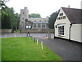
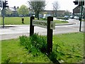
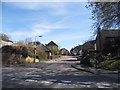
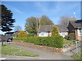
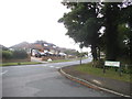
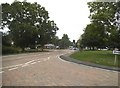
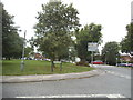
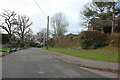
Photos of Caddington


Area Information
Caddington is a compact built-up area in England, spanning 84.9 hectares. It sits in a strategic location with easy access to transport networks, including multiple railway stations and proximity to London Luton Airport. The area’s median age of 70 suggests a community skewed towards older residents, though the data does not specify generational breakdowns. Home ownership is high at 81%, indicating a stable residential base. Daily life in Caddington is shaped by its proximity to essential services: nearby rail links connect to Luton and beyond, while local shops and schools cater to immediate needs. The area’s character blends practicality with convenience, offering a mix of retail options and transport hubs. For those prioritising connectivity, the broadband score of 96 ensures reliable digital access. While the demographic profile hints at a mature population, the presence of primary schools like Caddington Village School (rated good by Ofsted) suggests families are also part of the community. Caddington’s appeal lies in its balance of accessibility, safety, and local amenities, making it a viable choice for those seeking a settled, well-connected environment.
- Area Type
- Built Up Area 250
- Area Size
- 84.9 hectares
- Population
- Not available
- Population Density
- Not available
Residents of Caddington have access to a range of local amenities, including five retail outlets such as Co-op Caddington and Spar, which cater to daily shopping needs. The area’s rail connections to Luton and the nearby London Luton Airport provide easy access to broader regional and international travel. While the data does not detail parks or leisure facilities, the presence of multiple retail and transport options suggests a practical, service-oriented lifestyle. The proximity to schools and transport hubs means daily errands and commuting are efficiently managed. The mix of shops and transport links creates a convenient environment, though the absence of specific recreational amenities means outdoor activities may require travel beyond the immediate area. Overall, Caddington offers a functional lifestyle focused on accessibility and local services.
Amenities
Schools
Caddington is served by three primary schools: Heathfield Lower School, Willowfield Lower School, and Caddington Village School, which holds an Ofsted rating of good. These institutions provide a range of educational options for younger families, though the data does not include secondary schools or further education facilities. The presence of three primary schools suggests a focus on early education, with Caddington Village School’s good rating indicating a reliable standard of teaching. However, the absence of secondary school data means families requiring comprehensive education from primary to secondary levels may need to look beyond the immediate area. For those prioritising primary education, the variety of schools offers some choice, but the lack of higher-level institutions is a consideration for long-term family planning.
| Rank | School | Type | Entry gender | Ages |
|---|
Explore more schools in this area
Go to Schools tabDemographics
Caddington’s population has a median age of 70, with the most common age range encompassing the total population. This suggests a community predominantly composed of older residents, though specific generational or cohort data is not provided. Home ownership is high at 81%, indicating a stable housing market with fewer rental properties. The data does not specify household composition or accommodation types, but the overall figures suggest a relatively uniform demographic profile. The predominant ethnic group and religious composition are listed as totals, meaning no breakdowns are available. While this limits detailed analysis of diversity, the high home ownership rate implies a long-term resident base. The absence of specific deprivation data means quality-of-life factors like access to services or economic hardship cannot be assessed from the provided information. However, the presence of schools and transport links suggests the area is functional for its current population.
Household Size
Accommodation Type
Tenure
Ethnic Group
Religion
Household Composition
Age
Household Deprivation
NS-SEC
Explore more demographic insights in this area
Go to Demographics tabPlanning
Planning Constraints
- Crime RiskPremium