Area Overview for Bushey North Ward
Photos of Bushey North Ward
Area Information
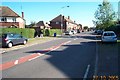
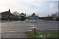
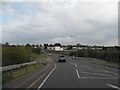
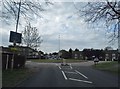
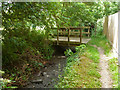
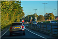
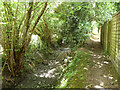
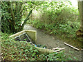
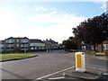
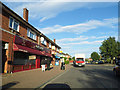
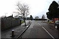
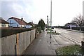
Living in Bushey North Ward means residing within the town of Bushey in the Hertsmere borough of Hertfordshire. This electoral ward covers a compact area of 3.0 km², forming part of the unparished urban environment that extends along Aldenham Road. The location sits northwards towards the Watford Borough boundary and borders the River Colne. Historically, this land was part of Bushey parish in the hundred of Dacorum, which underwent administrative splits in 1894 and 1906 before becoming part of the current Hertsmere borough structure in 1974. Today, the physical landscape is defined by the historic London and Birmingham Railway, also known as the West Coast Main Line. This major rail artery runs northwest of the ward, marked prominently by the Bushey Arches Viaduct constructed in 1837. The ward does not contain unique specific establishment dates or notable singular events recorded uniquely for its own boundaries, suggesting a seamless integration into the broader town history rather than a standalone origin story. The dominant road infrastructure includes Aldenham Road, which serves as a vital secondary link within the locality. You will experience a setting where historic railway infrastructure meets the established urban sprawl of Bushey. The boundaries clearly delineate the watershed between the Hertsmere and Watford administrative areas while maintaining the continuity of the town centre feel.
- Area Type
- District Borough Unitary Ward
- Area Size
- 3.0 km²
- Population
- Not available
- Population Density
- Not available
Demographics
The community in Bushey North Ward is characterised by a significantly older population profile. Data indicates a median age of 70 years, reflecting a constituency where seniors form the demographic backbone. While the specific breakdown of preferred age ranges is listed simply as "Total" in available records, the high median figure strongly suggests a retirement-dominant settlement. Ownership of property is widespread, with 68% of households reporting home ownership. This high rate implies a stable community where residents have long-term ties to their dwellings rather than transient tenancies. Household composition figures are categorised only as "Total", yet the ownership statistic outweighs the likelihood of a high-rental sector typically associated with younger professionals. You should expect a neighbourhood where generations have settled, evidenced by the ownership ceiling. The area lacks specific data on predominant ethnic groups or religious affiliations, but the demographic concentration points away from the mixed, younger mix found in many commuter towns. Instead, you are looking at a quiet, established environment where life pace aligns with retirement rather than career progression. The absence of granular data on diversity does not diminish the fact that this is a mature, owner-led locality.
Household Size
Accommodation Type
Tenure
Ethnic Group
Religion
Household Composition
Age
Household Deprivation
NS-SEC
Explore more demographic insights in this area
Go to Demographics tabPlanning
Planning Constraints
- Flood RiskPremium
- Ramsar Wetland SitesPremium
- Area of Outstanding Natural BeautyPremium
- Protected Nature ReservePremium
- Protected WoodlandPremium
- Crime RiskPremium