Area Overview for Bushey Heath Ward
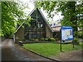
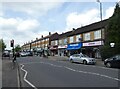
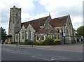
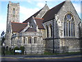
Photos of Bushey Heath Ward
Area Information
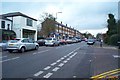
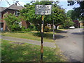
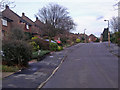
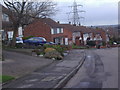
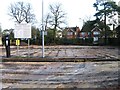
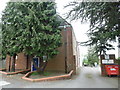
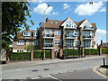
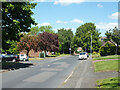
Bushey Heath Ward sits at the edge of Hertfordshire, straddling the boundary with the London Borough of Harrow. This district covers just 3.3 square kilometres, creating a compact neighbourhood where residents often know their surroundings well. The area reaches an elevation of 165 metres above sea level, including the highest point in historic Middlesex at 153 metres near the junction of the A4140 and A409. You will find this ward characterised by its elevated position and a mix of established residential areas. It serves as a suburban village neighbourhood southeast of Bushey town, offering a distinct lifestyle for those working or travelling between Hertfordshire and London. The High Road Bushey Heath Conservation Area runs along the border with Harrow, adding historical character to the streetscape. Residents here enjoy proximity to the London and Birmingham Railway line, which crosses the area via the Bushey Arches Viaduct built in 1837. Although plans for a station at Elstree Road never materialised, the transport links remain significant for daily commutes. The ward has maintained a manageable population, growing from 4,854 people in 2001 to 5,427 in 2021. This gentle expansion suggests stable community growth without overcrowding. Living in Bushey Heath Ward means benefiting from a mix of suburban convenience and elevated green surroundings. The area's location on the Hertfordshire-London border offers practical access to both county services and London amenities.
- Area Type
- District Borough Unitary Ward
- Area Size
- 3.3 km²
- Population
- Not available
- Population Density
- Not available
Demographics
The community in Bushey Heath Ward reflects an older demographic profile, with a median age of 70. This figure indicates a neighbourhood where older adults form a significant portion of the population. You are likely to encounter a settled crowd that values stability and local familiarity. The ward consists of 5,427 residents, a population that has grown steadily over recent decades. Home ownership stands at an impressive 70%, showing that most households have purchased their properties rather than renting. This high level of ownership suggests a community invested in long-term stability and local estate value. The residential composition leans heavily towards owner-occupied homes, creating an environment where residents often take a vested interest in the upkeep and appearance of their streets. While specific data on household composition and predominant ethnic groups is not detailed in the provided statistics, the presence of a notable Jewish community of 2,015 residents in the wider Bushey area in 2021 adds cultural diversity to the local context. The low population density within this small 3.3 km² area contributes to a quieter domestic life compared to larger urban wards.
Household Size
Accommodation Type
Tenure
Ethnic Group
Religion
Household Composition
Age
Household Deprivation
NS-SEC
Explore more demographic insights in this area
Go to Demographics tabPlanning
Planning Constraints
- Flood RiskPremium
- Ramsar Wetland SitesPremium
- Area of Outstanding Natural BeautyPremium
- Protected Nature ReservePremium
- Protected WoodlandPremium
- Crime RiskPremium