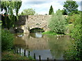
Area Overview for Bury St Edmunds
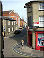
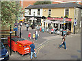
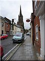
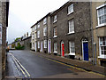
Photos of Bury St Edmunds


Area Information
Bury St Edmunds is a compact town in England, covering 14.6 km² with a population of 7,303 people. Its population density of 500 people per square kilometre suggests a tightly knit community, where daily life is shaped by local traditions and proximity to amenities. The area’s character is defined by its historical roots, with a blend of traditional architecture and modern infrastructure. Residents benefit from nearby retail hubs like M&S Bury and Tesco St, as well as accessible rail links to Bury St Edmunds and Thurston stations. The median age of 70 indicates a community skewed toward older residents, which influences the pace of life and the types of services available. For those seeking a quieter, well-connected town with a balance of heritage and practicality, Bury St Edmunds offers a distinct alternative to larger urban centres. Its manageable size ensures that most needs are within walking or cycling distance, making it appealing to those prioritising convenience and community.
- Area Type
- Built Up Area 250
- Area Size
- 14.6 km²
- Population
- 7303
- Population Density
- 500 people/km²
Bury St Edmunds offers a practical lifestyle with a range of amenities within easy reach. Retail options include M&S Bury, Cook Bury, and Tesco St, catering to everyday needs. The area’s rail stations, such as Bury St Edmunds and Thurston, connect residents to broader transport networks, facilitating commuting or weekend trips. For families, the proximity of primary schools like Westgate Community Primary School and Guildhall Feoffment Community Primary School adds to the convenience. While the data does not specify parks or leisure facilities, the town’s compact size likely means short travel times to green spaces or local events. The mix of retail, transport, and education options supports a self-contained lifestyle, ideal for those seeking a balance between accessibility and tranquillity.
Amenities
Schools
The schools nearest to Bury St Edmunds include Guildhall Feoffment Community Primary School and Westgate Community Primary School and Nursery, both rated ‘good’ by Ofsted. Other primary schools in the area are Tollgate Primary School, Sexton’s Manor Community Primary School, and Albany PRU. The presence of multiple primary schools provides families with options, though no secondary schools are listed in the data. The ‘good’ Ofsted ratings suggest a generally reliable standard of education for younger children, which is a key consideration for families. However, the absence of secondary school data means prospective buyers may need to research further for older children’s schooling. The concentration of primary schools reflects the area’s focus on early education and family-friendly infrastructure.
| Rank | School | Type | Entry gender | Ages |
|---|
Explore more schools in this area
Go to Schools tabDemographics
The population of Bury St Edmunds has a median age of 70, significantly higher than the national average, indicating a community predominantly composed of older residents. Home ownership stands at 63%, suggesting a stable, long-term resident base rather than a transient rental market. The data does not specify household composition or ethnic diversity, but the high median age implies services and amenities may be tailored to older demographics. This profile shapes the area’s social dynamics, with a focus on retirement living and community engagement. While no explicit deprivation data is provided, the relatively high home ownership rate and moderate population density suggest a mix of self-sufficiency and reliance on local services. For prospective buyers, this demographic profile may influence the availability of age-appropriate housing and community facilities.
Household Size
Accommodation Type
Tenure
Ethnic Group
Religion
Household Composition
Age
Household Deprivation
NS-SEC
Explore more demographic insights in this area
Go to Demographics tabPlanning
Planning Constraints
- Crime RiskPremium