Area Overview for Burston
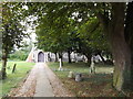
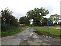
Photos of Burston


Area Information
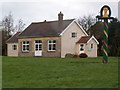
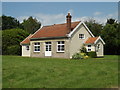
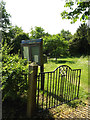
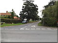
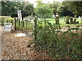
Burston is a compact built-up area in England, spanning 22.2 hectares. It is home to a population with a median age of 70, reflecting a community that leans toward older residents. The area’s modest size means it is tightly knit, with daily life shaped by proximity to key amenities. Residents benefit from a railway station at Diss, just a short distance away, and a cluster of retail outlets including Aldi, Morrisons, and Tesco in Diss. The high home ownership rate—72%—suggests a stable, long-term resident base. While Burston lacks the density of a major city, its small footprint ensures a quiet, low-traffic environment. For those seeking a retirement or semi-retired lifestyle, the area offers a blend of practicality and accessibility. The broadband score of 93 indicates excellent internet connectivity, supporting remote work or leisure. However, mobile coverage scores at 79 are good but not exceptional, which may affect reliance on cellular data. Burston’s character is defined by its simplicity: a place where convenience and calm coexist, ideal for those prioritising ease of access to services over urban vibrancy.
- Area Type
- Built Up Area 250
- Area Size
- 22.2 hectares
- Population
- Not available
- Population Density
- Not available
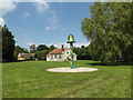
Living in Burston provides access to a range of nearby amenities that support daily life. The Diss area includes several retail stores, such as Aldi, Morrisons, and Tesco, offering convenience for shopping and errands. These stores are within practical reach, reducing the need for long journeys to larger centres. The Diss Railway Station is a key transport hub, enabling residents to travel to other towns and cities with ease. While the area does not have extensive parks or leisure facilities listed in the data, the proximity to Diss suggests that residents can access recreational spaces and community events in the surrounding town. The retail and transport options available in Burston contribute to a lifestyle that balances practicality with accessibility. For those who value a straightforward, service-oriented environment, the area’s amenities provide the essentials without the complexity of a larger urban setting.
Amenities
Schools
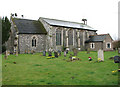
The nearest school to Burston is Burston Community Primary School, which serves the local area and is rated 'good' by Ofsted. This primary school is the only educational institution explicitly mentioned in the data, indicating that the area’s school provision is focused on early education. While no secondary schools are listed, the presence of a primary school with a positive rating suggests that families with young children may find the area suitable for their needs. The absence of higher education institutions or additional schools means that students may need to travel to nearby towns for secondary education. However, the 'good' Ofsted rating for the primary school is a positive indicator for families prioritising quality early education. For those considering Burston as a place to live, the availability of a rated primary school is a key factor, though further research would be needed to assess the broader educational landscape for older students.
| Rank | School | Type | Entry gender | Ages |
|---|
Explore more schools in this area
Go to Schools tabDemographics
Burston’s population has a median age of 70, placing it well above the national average. This suggests a community predominantly composed of older adults, likely retired or semi-retired individuals. The home ownership rate of 72% indicates that most residents live in their own homes, which may reflect a preference for stability over rental properties. The data does not specify household composition or accommodation types, but the high home ownership percentage implies a mix of owner-occupied homes, possibly including family residences or multi-generational living. The absence of detailed information on ethnic diversity or religious composition means these aspects cannot be addressed. However, the age profile suggests a demographic that may prioritise low-maintenance housing and proximity to essential services. The area’s older population may also influence local amenities, with a focus on healthcare access and community centres. For buyers, this demographic profile indicates a market where properties are likely to remain occupied for extended periods, offering security for long-term investment.
Household Size
Accommodation Type
Tenure
Ethnic Group
Religion
Household Composition
Age
Household Deprivation
NS-SEC
Explore more demographic insights in this area
Go to Demographics tabPlanning
Planning Constraints
- Crime RiskPremium