Area Overview for Burnham Market & Docking Ward
Photos of Burnham Market & Docking Ward
Area Information
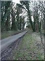
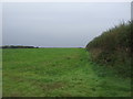
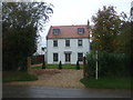
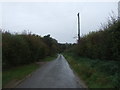
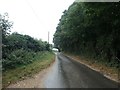
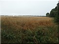
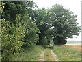
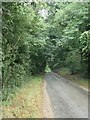
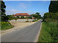
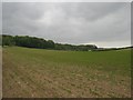
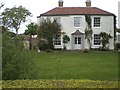
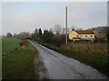
Living in Burnham Market & Docking Ward offers a distinctly rural Norfolk experience. This district borough unitary ward covers an area of 88.2 km² within the Eastern Region of England. The location is defined by its traditional landscape and smaller villages rather than urban sprawl. Burnham Market and Docking form the core settlements of this ward, situated at approximately 52.93° N, 0.69° W. Residents here navigate a community shaped by historical remains, including the ruins of a Carmelite Friary and dismantled Victorian railway infrastructure. The ward sits within the B1155 and B1355 road network, connecting local streets such as Front Street, North Street, The Green, and Herring's Lane to the wider region. Daily life centres around local amenities found in these villages, including allotment gardens, a bowling green, and the Oval recreational area. St Margaret's Church remains a focal point for the community. While historical economic drivers like mining are noted in regional records, the current atmosphere relies on the quiet character of North Norfolk. Prospective buyers should understand that this ward represents a specific slice of the county, balancing historical significance with modern living needs in a countryside setting. The 88.2 km² footprint provides space for residents to spread out while remaining part of a structured administrative unit under Kings Lynn and West Norfolk Borough Council.
- Area Type
- District Borough Unitary Ward
- Area Size
- 88.2 km²
- Population
- Not available
- Population Density
- Not available
Demographics
The community within Burnham Market & Docking Ward presents a clear demographic profile. The median age for residents reaches 70, indicating a population skewed significantly towards older adults. The data lists Age: Total as the most common age range, reflecting this high median figure. Consequently, the neighbourhood attracts individuals seeking a quieter retirement environment or those closer to family members. Home ownership stands at 63%, which is a substantial majority for the ward. This high rate of ownership suggests that most residents have long-term ties to the area rather than relying on the rental market. The ward does not provide specific figures for predominant ethnic groups or religious affiliations, but the settlement characteristics align with traditional rural英格兰 communities. Household composition and accommodation type data are recorded in the overall totals without further breakdown. This demographic structure implies a stable population where residents likely value heritage and established local services. The high proportion of owner-occupiers often correlates with families who have remained in the same address for decades or retirees who have secured their homes early in life. Living in Burnham Market & Docking Ward means joining a community where the majority have secured their own dwellings and where the average resident is considerably older than the national median.
Household Size
Accommodation Type
Tenure
Ethnic Group
Religion
Household Composition
Age
Household Deprivation
NS-SEC
Explore more demographic insights in this area
Go to Demographics tabPlanning
Planning Constraints
- Flood RiskPremium
- Ramsar Wetland SitesPremium
- Area of Outstanding Natural BeautyPremium
- Protected Nature ReservePremium
- Crime RiskPremium