Area Overview for Burlingham Ward
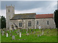
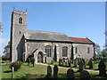
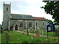
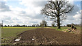
Photos of Burlingham Ward


Area Information
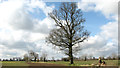
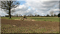
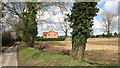
Living in Burlingham Ward means settling into a rural district within Norfolk's Broadland area, covering a geographical area of 9.4 square kilometres. You are entering an electoral ward that encompasses rural parishes including parts of Lingwood and the village itself. The community is compact, with a total population of 1,410 residents, which creates a tight-knit village atmosphere rather than a sprawling suburban sprawl. You will find that the average street likely serves fewer than two hundred people, fostering familiar encounters with neighbours. Daily life centres around local village amenities and open countryside, typical of the Eastern Region of England. The ward exists as a distinct administrative unit, blending parish life with broader district services. For those considering homes in Burlingham Ward, the sheer size of the area is manageable enough to know its streets without a map, yet large enough to offer separation between residential clusters and open land. You live in a space defined by its rural character and low population density, where the pace of life moves slower than in the nearest main towns.
- Area Type
- District Borough Unitary Ward
- Area Size
- 9.4 km²
- Population
- 1410
- Population Density
- 1349 people/km²
Demographics
The community in Burlingham Ward reflects a mature population structure with a median age of 70 years. This demographic profile indicates that the ward holds a significant proportion of retirement-age residents or families with older children. The household composition data categorises the total demographic makeup, suggesting a reliance on established family units or older occupants. Home ownership stands at 77 per cent, revealing that the vast majority of people in Burlingham Ward own their properties outright or through a mortgage. This exceptionally high ownership rate points to a stable neighbourhood where long-term residents are deeply rooted in the locality rather than transient renters. Accommodation types cover the total housing stock available within the ward boundaries. While specific ethnic group breakdowns are not detailed in the current record, the homogeneity suggested by the ownership figures implies a traditional village demographic. You are purchasing into an established community where generational ties to the land are common, and the social fabric is woven from long-standing connections rather than recent migration waves.
Household Size
Accommodation Type
Tenure
Ethnic Group
Religion
Household Composition
Age
Household Deprivation
NS-SEC
Explore more demographic insights in this area
Go to Demographics tabPlanning
Planning Constraints
- Flood RiskPremium
- Ramsar Wetland SitesPremium
- Area of Outstanding Natural BeautyPremium
- Protected Nature ReservePremium
- Crime RiskPremium