Area Overview for Buntingford
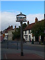
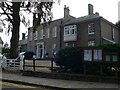
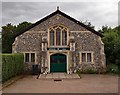
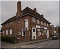
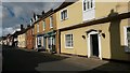
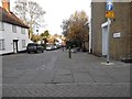
Photos of Buntingford


Area Information
Living in Buntingford offers a distinct experience within a built-up area covering just 2.0 km². This compact size means the town centre and residential streets are within easy walking distance for most residents. The community feels settled and established, characterised by a high level of local connection. Prospective buyers visiting Buntingford will find a residential environment that prioritises stability over rapid expansion. Daily life revolves around a mix of older traditional housing and local amenities. The small geographical footprint ensures that essential services are never far away. You do not need to travel far to access supermarkets, newsagents, or public transit links. This layout suits those who value convenience and do not wish to spend significant time commuting locally. The area functions as a cohesive unit where the town centre and housing estates blend seamlessly. Residents enjoy a sense of familiarity that comes from living in a contained community. Whether you are walking your children to school or visiting a café, the distances are manageable. Buntingford presents itself as a practical choice for those seeking a grounded, accessible location. The compact nature of the town creates an efficient living environment where neighbours know each other. You will find a place where everyday errands require minimal effort and travel time. This approach to urban planning makes Buntingford an attractive option for favouring simplicity in daily routines.
- Area Type
- Built Up Area 250
- Area Size
- 2.0 km²
- Population
- Not available
- Population Density
- Not available
The lifestyle in Buntingford revolves around convenient access to essential retail outlets within the town limits. Residents have practical reach of four main retail locations, ensuring daily shopping needs are met without a journey to larger towns. Budgens Buntingford, Sainsburys Buntingford, and Co-op Buntingford form the core of the local high street offering. These supermarkets provide a wide range of grocery items, beverages, and household essentials. You can complete your weekly food shop without needing a car, although the small area size makes walking feasible. This concentration of shops creates a self-sufficient street economy where locals support local businesses. The presence of multiple retailers indicates a healthy level of footfall and commercial activity. Dining options and cash points are likely interspersed along this accessible route. The lifestyle here is defined by convenience and independence from long car journeys. Residents do not need to travel beyond the 2.0 km² boundary for basic necessities. This layout supports a slow-paced, mindful approach to daily errands. The ability to buy groceries, post mail, and pick up prescriptions locally adds significant value to homeowner quality of life. This retail availability is a key factor for those prioritising time-saving in their routine. The proximity of these shops to residential zones ensures that even older residents can maintain an active lifestyle. You enjoy the benefit of carrying out almost all domestic tasks within easy walking distance.
Amenities
Schools
Families with children looking for schools near Buntingford have access to several local options with varying ratings. Millfield First and Nursery School operates in the area and holds a good Ofsted rating. Parents seeking primary education often consider Edwinstree Church of England Middle School, which also carries a good rating under the Ofsted inspection framework. Layston Church of England First School presents another choice with a satisfactory Ofsted rating. Potential residents should note that the dataset does not list Ofsted ratings for Freman College or the Buntingford Area Pupil Referral Unit. This absence of specific inspection grades means you must investigate current inspection statuses directly for these institutions. The mix of rated schools suggests a willingness by local authorities to maintain educational standards in Buntingford. However, the limited data on secondary provision in the provided lists requires further local research before making school-commuting decisions. You will find both primary and specialist provision within practical reach. The presence of a pupil referral unit indicates support mechanisms for specific student needs. When evaluating homes in Buntingford, the distance to these named schools becomes a key decision factor. The spread of good and satisfactory ratings provides a balanced educational environment for younger residents.
| Rank | School | Type | Entry gender | Ages |
|---|
Explore more schools in this area
Go to Schools tabDemographics
The community in Buntingford displays a clear demographic profile shaped by long-term residency. Seven in ten residents in Buntingford own their homes, reflecting a strong culture of home ownership at 77 per cent. This high rate indicates that the majority of households have established roots in the area rather than being transient renters. The population median age stands at 70 years, suggesting a significant presence of retired individuals and older residents. This age structure influences the vibrancy of public spaces and the demand for specific local services. The lack of data on specific household composition categories means we rely on the overarching trend of ownership. Homeowners in Buntingford likely have been in their properties for many years, contributing to a stable neighbourly atmosphere. The median age of 70 suggests that families with young children may be a smaller segment of the population. Instead, you will find retirees enjoying the quieter pace of life that the area offers. This demographic reality shapes the type of commercial landlords who operate in Buntingford. They often cater to older residents with specific needs. The area does not exhibit characteristics of a fast-moving rental or student market. Instead, it provides a consistent environment suitable for those wishing to settle down. The 77 per cent ownership figure underscores the permanence of the community. You can expect interactions that build over decades rather than months. This stability creates a predictable social landscape for anyone choosing to live in Buntingford.
Household Size
Accommodation Type
Tenure
Ethnic Group
Religion
Household Composition
Age
Household Deprivation
NS-SEC
Explore more demographic insights in this area
Go to Demographics tabPlanning
Planning Constraints
- Crime RiskPremium