Area Overview for Bumble's Green
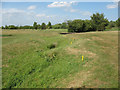
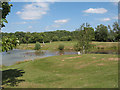
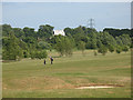
Photos of Bumble's Green

Area Information
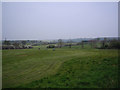
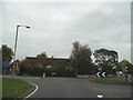
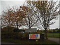
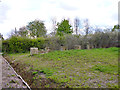
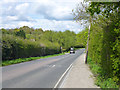
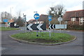
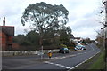
Bumble’s Green is a compact built-up area in England, covering 25 hectares and serving as a practical, accessible community. With a median age of 70, it reflects a population skewed toward older residents, suggesting a mature demographic profile. The area’s home ownership rate of 80% indicates a stable, long-term resident base, with many properties likely passed through generations. Daily life here is shaped by proximity to essential services, including five nearby railway stations such as Broxbourne and Cheshunt, which provide direct links to London and surrounding towns. Retail options like Co-op Upshire, Waitrose Broxbourne, and Sainsburys Broxbourne ensure convenience for shopping. Digital connectivity is robust, with a broadband score of 98 and mobile coverage of 83, supporting both work and leisure. Bumble’s Green balances practicality with accessibility, offering a quiet yet connected environment for those prioritising ease of movement and reliable infrastructure.
- Area Type
- Built Up Area 250
- Area Size
- 25.0 hectares
- Population
- Not available
- Population Density
- Not available
Living in Bumble’s Green offers a blend of convenience and accessibility. Nearby retail options include Co-op Upshire, Waitrose Broxbourne, and Sainsburys Broxbourne, providing a range of shopping experiences. The proximity to railway stations like Broxbourne and Cheshunt ensures easy access to London and surrounding areas, while metro stations such as Epping Underground Station offer additional transport links. The presence of North Weald Airport adds to the area’s connectivity for air travel. These amenities contribute to a lifestyle where daily needs are met without the need for long commutes. The mix of retail, transport, and nearby services creates a practical environment for residents prioritising ease of movement and access to essential facilities.
Amenities
Schools
| Rank | A + A* % | School | Type | Entry gender | Ages |
|---|
Explore more schools in this area
Go to Schools tabDemographics
The population of Bumble’s Green has a median age of 70, with the most common age range encompassing all demographics. This suggests a community where older residents form a significant portion of the population. Home ownership is high, with 80% of households owning their properties, reflecting a settled, long-term demographic. Accommodation types and household compositions are recorded as totals, meaning no specific breakdowns are available. The area’s data does not specify ethnic or religious diversity, but the absence of detailed figures means assumptions about cultural mix cannot be made. The lack of deprivation data implies no specific challenges are highlighted, though this does not confirm the absence of socioeconomic issues. For buyers, this profile suggests a community with stable housing and a focus on long-term residency.
Household Size
Accommodation Type
Tenure
Ethnic Group
Religion
Household Composition
Age
Household Deprivation
NS-SEC
Explore more demographic insights in this area
Go to Demographics tabPlanning
Planning Constraints
- Crime RiskLocked