Area Overview for Bucklesham
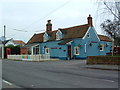
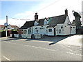
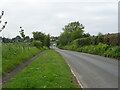
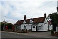
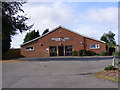
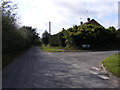
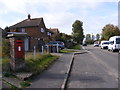
Photos of Bucklesham

Area Information
Bucklesham is a compact built-up area spanning 22.8 hectares, nestled in England. Its small size means residents benefit from a tight-knit community feel, with daily life shaped by proximity to essential services. The area’s population skews older, with a median age of 70, suggesting a demographic of long-term residents and retirees. Home ownership is high, at 81%, indicating a stable housing market. While Bucklesham lacks the density of a major city, its strategic location offers access to nearby towns and transport links. The area’s character is defined by practicality—retail options like Makro Ipswich and Morrisons Daily Martlesham cater to everyday needs, while rail stations such as Derby Road provide connections to broader networks. For those seeking a quieter lifestyle, Bucklesham’s low crime risk and well-maintained infrastructure make it appealing. However, its small size means it is not a destination for large-scale retail or leisure, requiring residents to look beyond the immediate vicinity for more extensive amenities.
- Area Type
- Built Up Area 250
- Area Size
- 22.8 hectares
- Population
- Not available
- Population Density
- Not available
Bucklesham’s lifestyle is defined by its practical amenities and proximity to transport. Retail options include Makro Ipswich, Aldi Gloster, and Morrisons Daily Martlesham, offering a range of grocery and household goods. The five rail stations, including Derby Road, provide access to nearby towns and cities, while ferry services at Shotley Point and Harwich Harbour open up opportunities for coastal travel or commuting. Although the area itself lacks large parks or entertainment venues, its location near practical amenities ensures residents can meet daily needs without long journeys. The presence of multiple transport options enhances mobility, allowing residents to balance local convenience with access to broader networks. For those prioritising ease of access over sprawling leisure facilities, Bucklesham’s amenities deliver a functional, if modest, lifestyle.
Amenities
Schools
| Rank | A + A* % | School | Type | Entry gender | Ages |
|---|
Explore more schools in this area
Go to Schools tabDemographics
Bucklesham’s population has a median age of 70, reflecting a community dominated by older adults. The most common age range is listed as “Total,” suggesting data aggregation rather than specific groupings. Home ownership is high, with 81% of residents owning their homes—a figure that implies stability and long-term residency. Accommodation types and household compositions are not specified in the data, but the high ownership rate suggests a mix of family homes and single-occupancy properties. The area’s demographic profile does not include details on ethnic diversity or religious composition, which are both listed as “Total.” This lack of specificity means the community’s cultural makeup remains unclear. The absence of deprivation data means it is not possible to assess how socioeconomic factors might influence quality of life. However, the high home ownership rate and low crime risk suggest a generally secure and settled population.
Household Size
Accommodation Type
Tenure
Ethnic Group
Religion
Household Composition
Age
Household Deprivation
NS-SEC
Explore more demographic insights in this area
Go to Demographics tabPlanning
Planning Constraints
- Crime RiskLocked